Environmental and Cultural Collapse of Louisiana’s Vanishing Coast
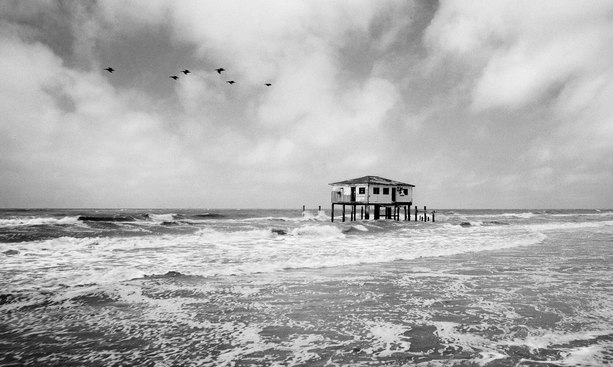
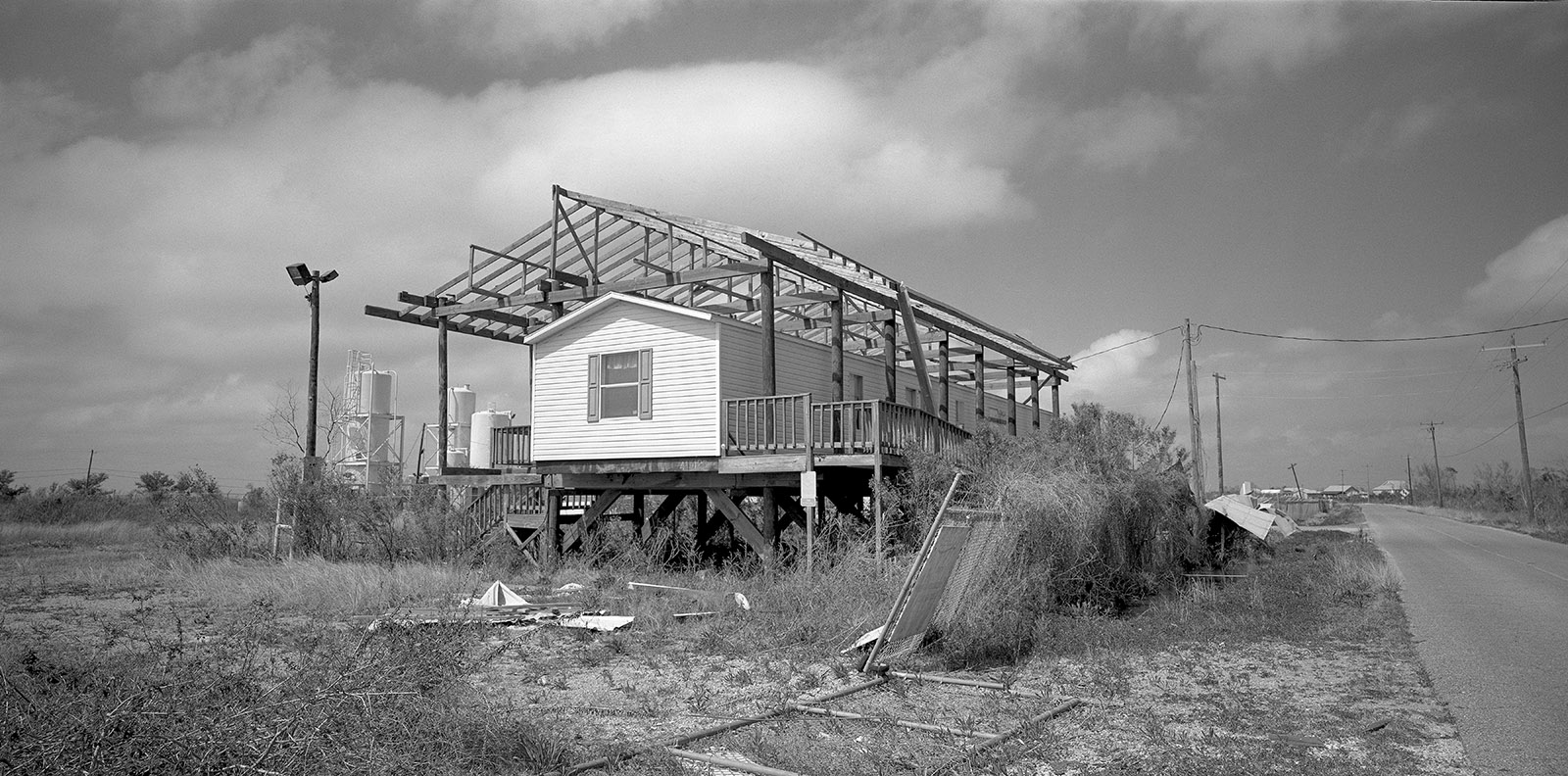
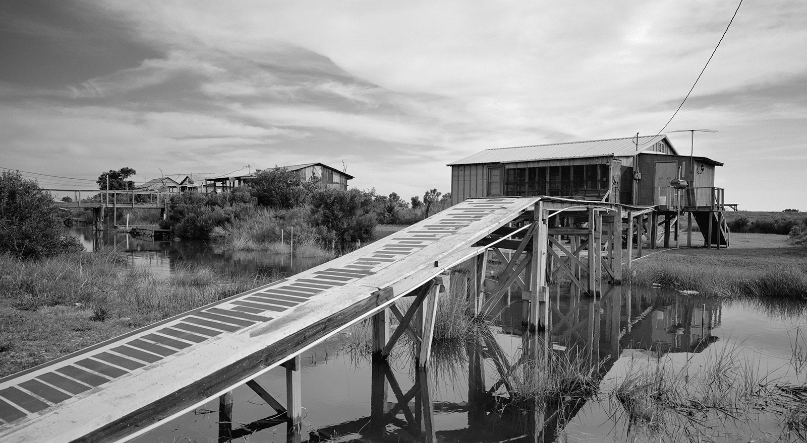
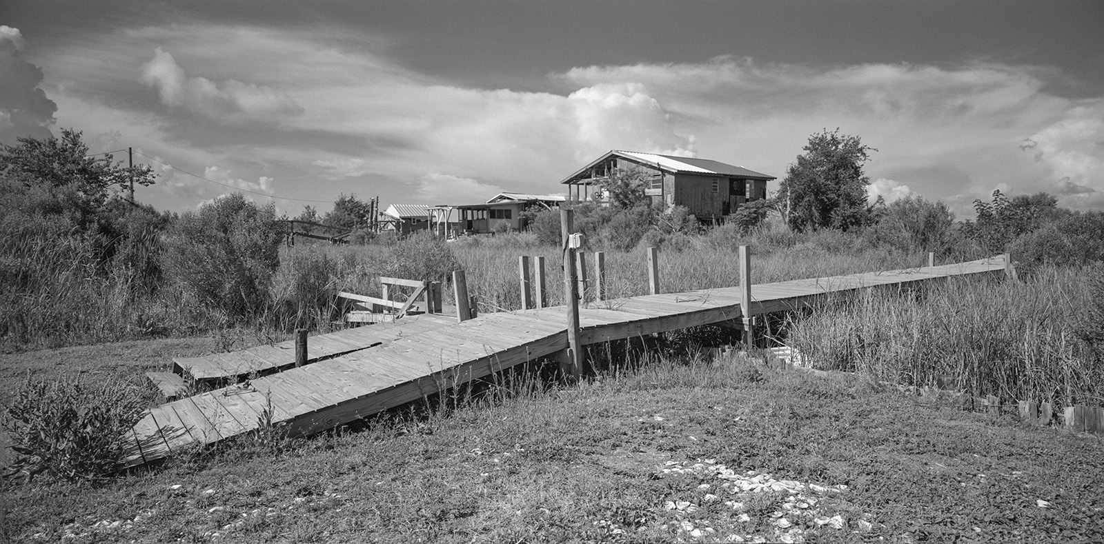
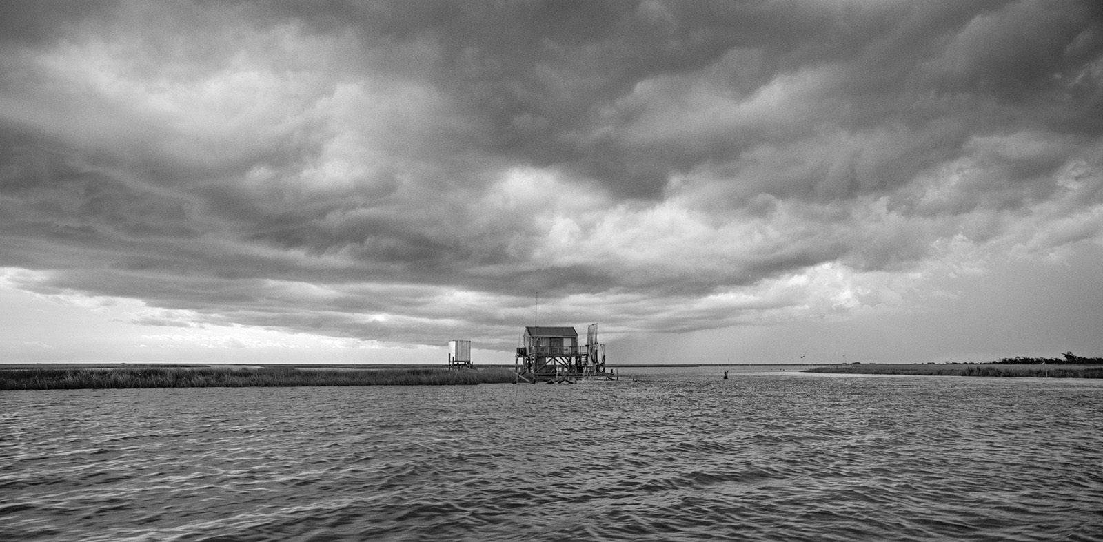
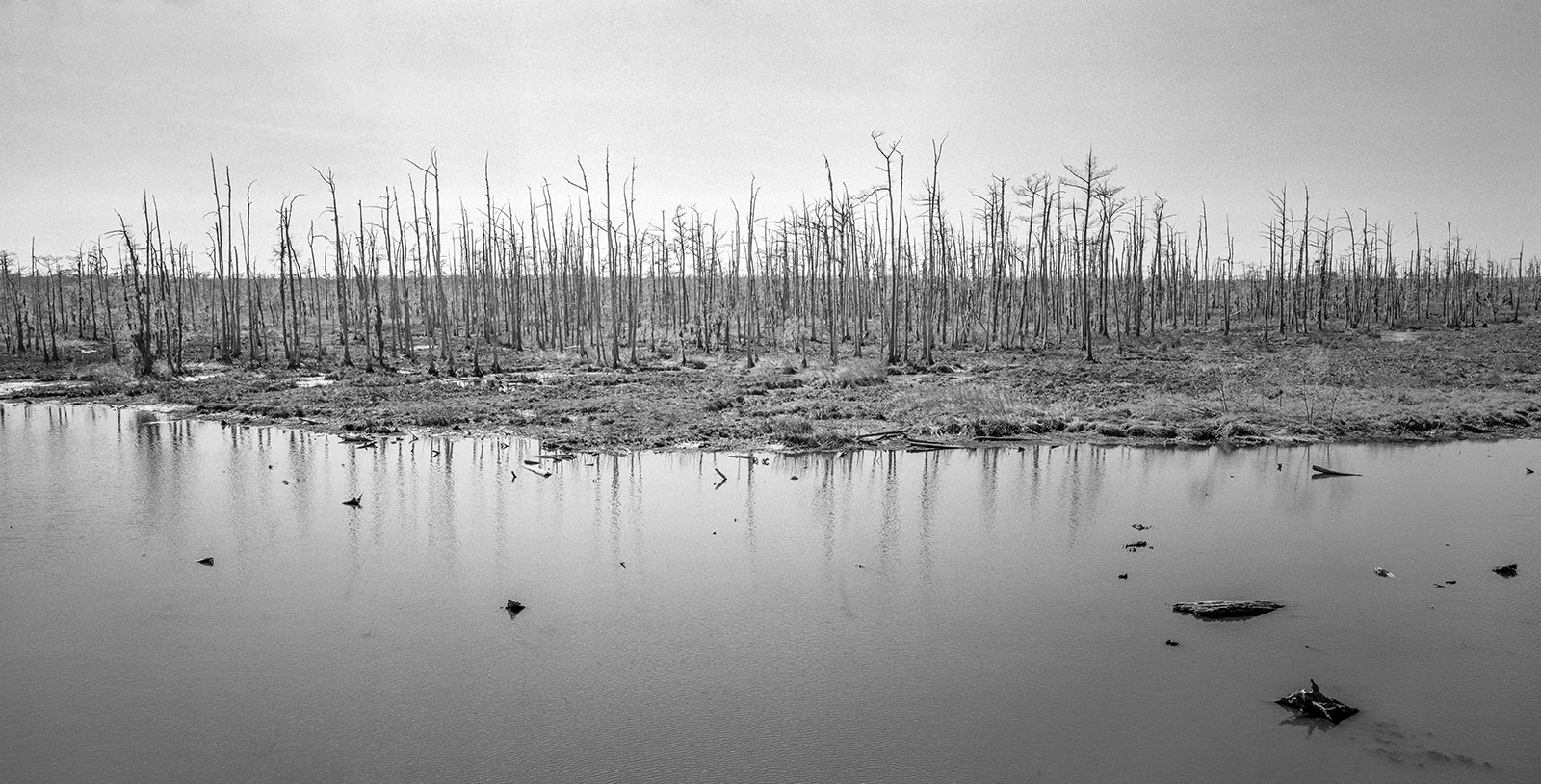
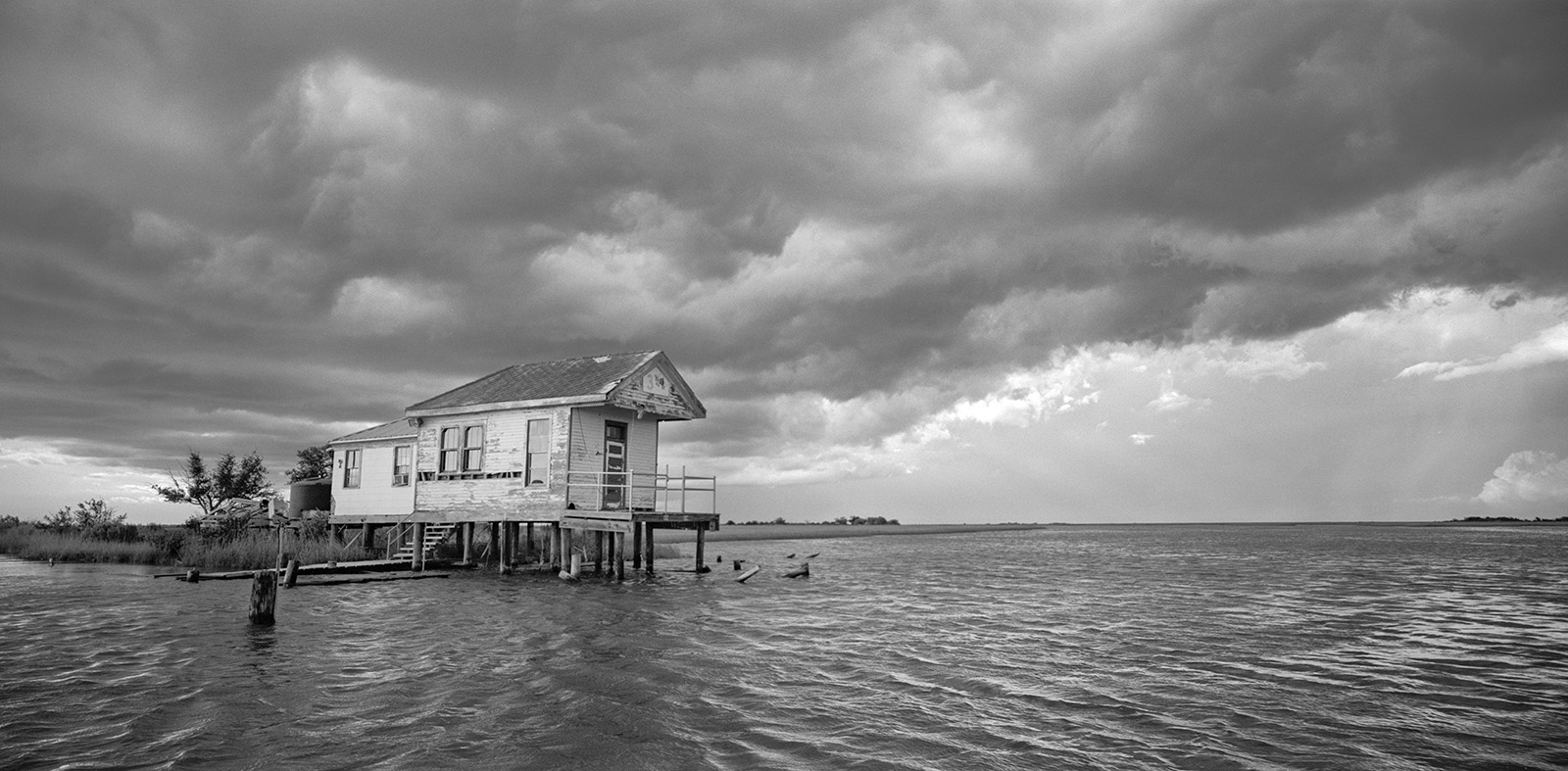
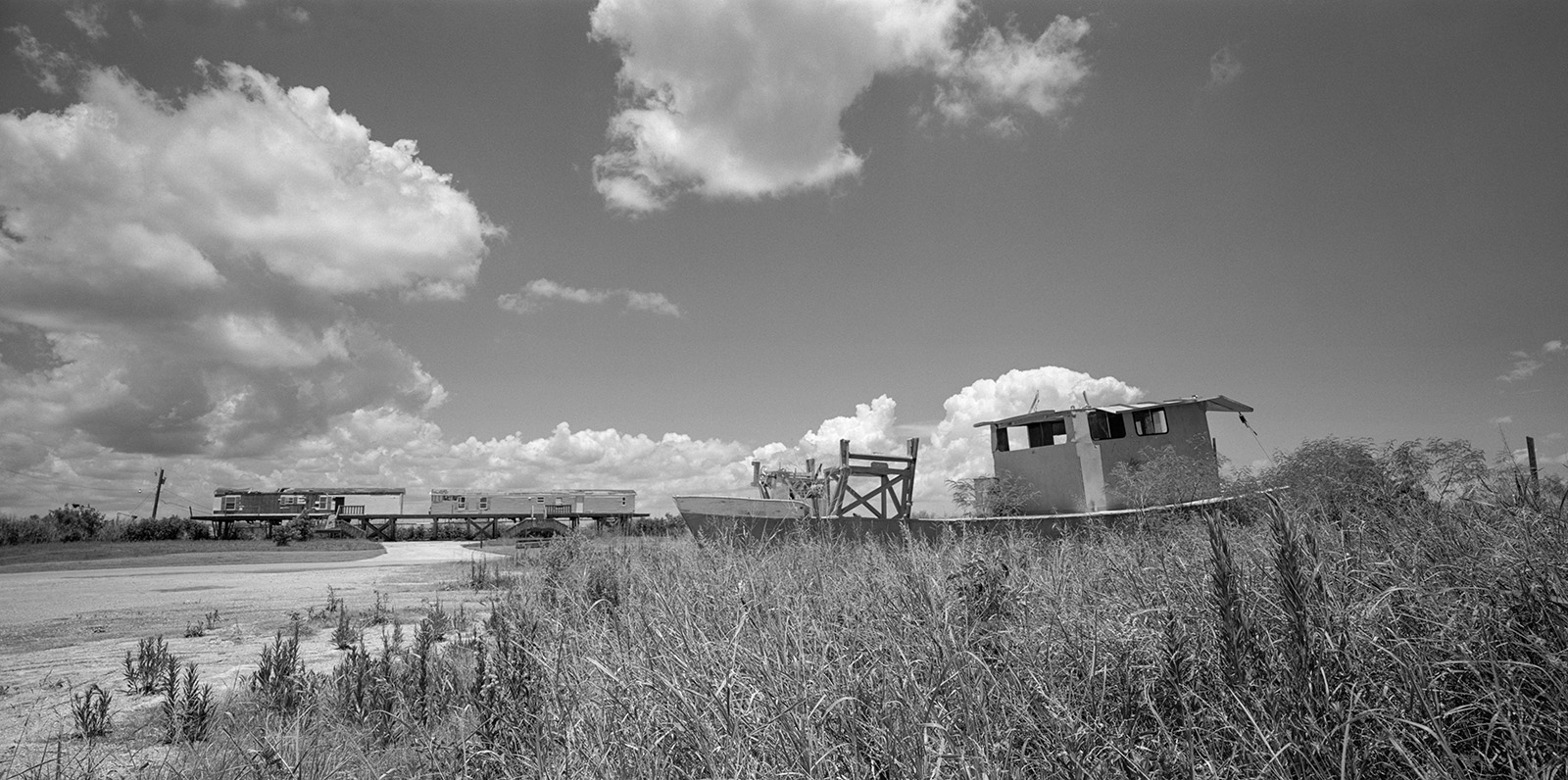
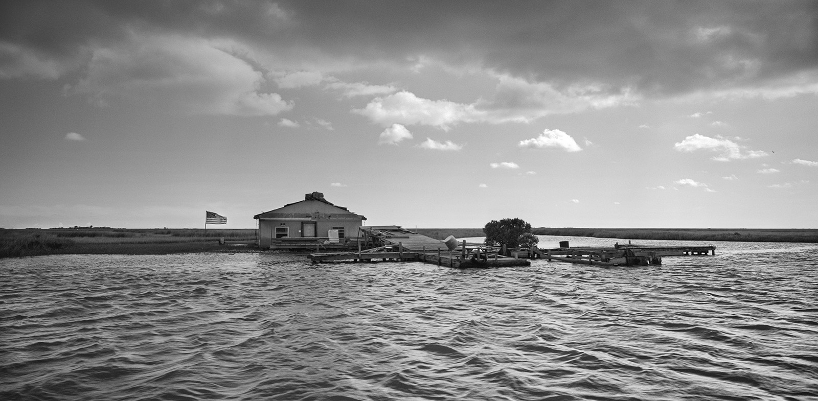
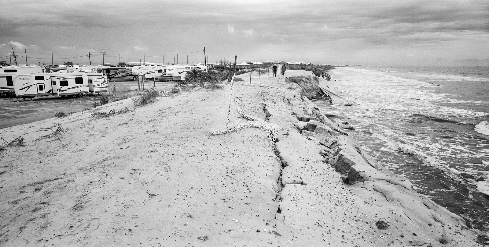
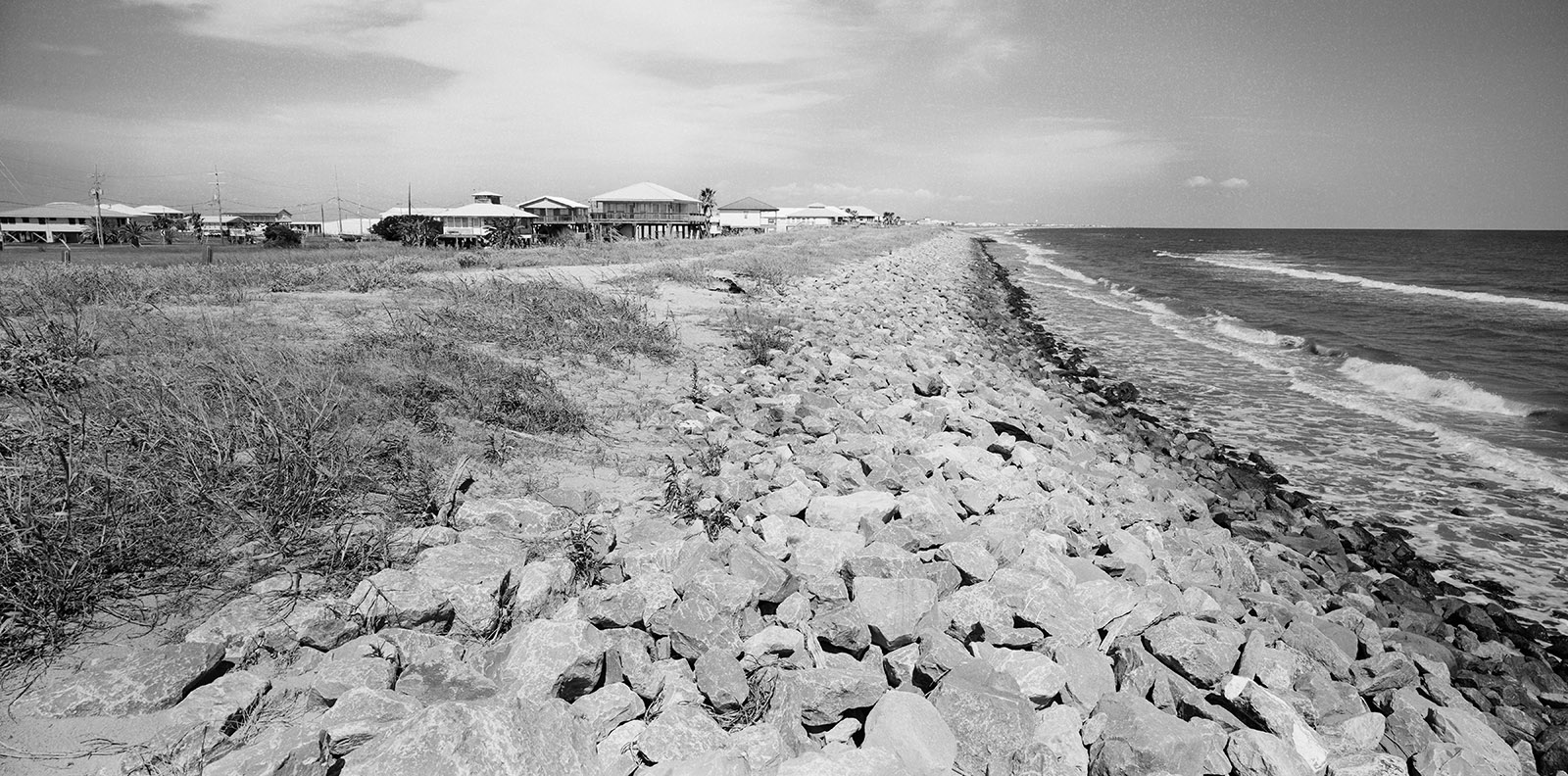
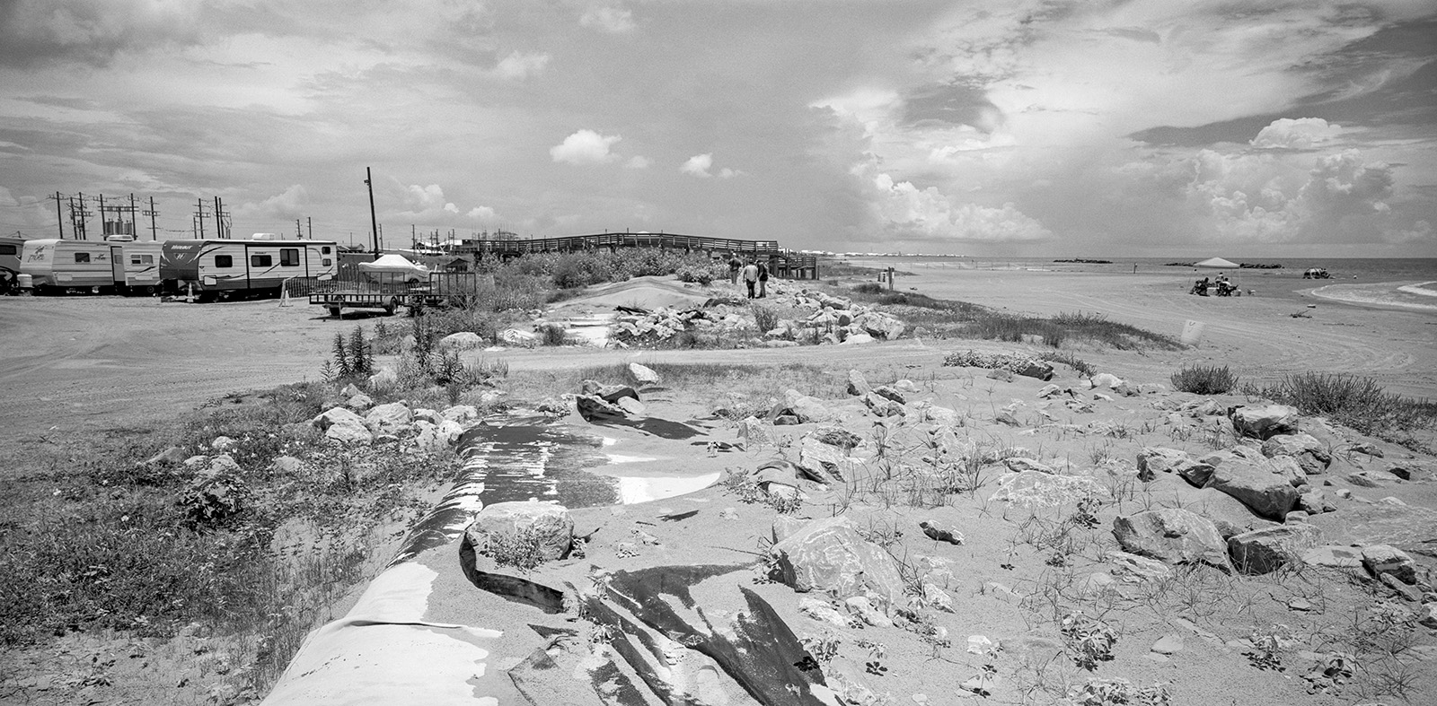
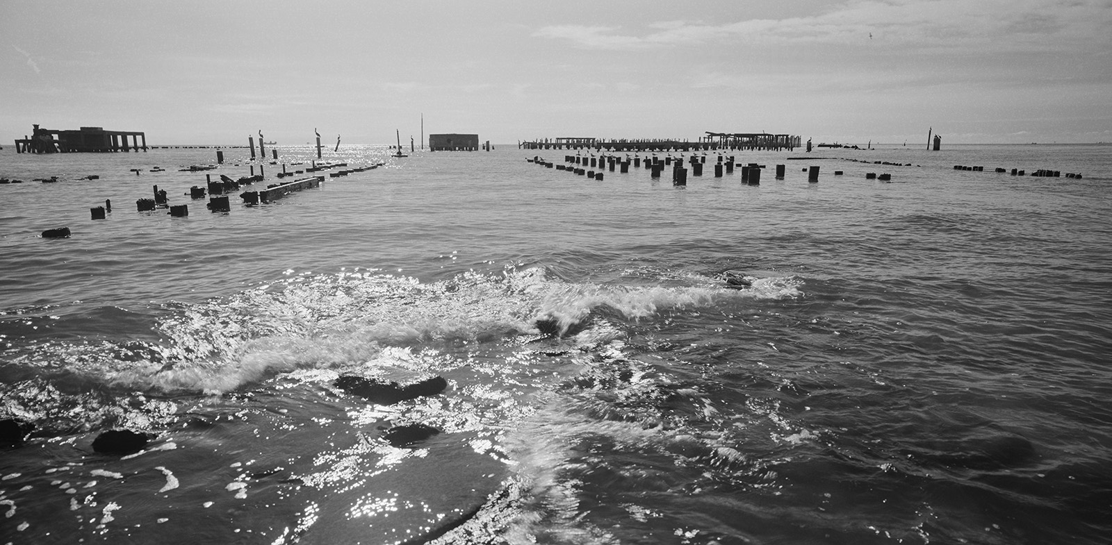
Louisiana is at the forefront of global sea level change, experiencing the highest rate of coastal erosion in America, losing about one hundred yards of land every thirty minutes- land loss the size of a football field every half-hour. These images are a recent selection of a long-term investigation of rapid changes in wetlands geography and population in Southern Louisiana, largely due to human activity. The photographs are results of more than two decades of annual revisitation of the specific geographic area, The Barataria-Terrebonne National Estuary. Witnessing this physical unraveling of landscape became a personal visual metaphor for the disintegration of my native country of Yugoslavia.
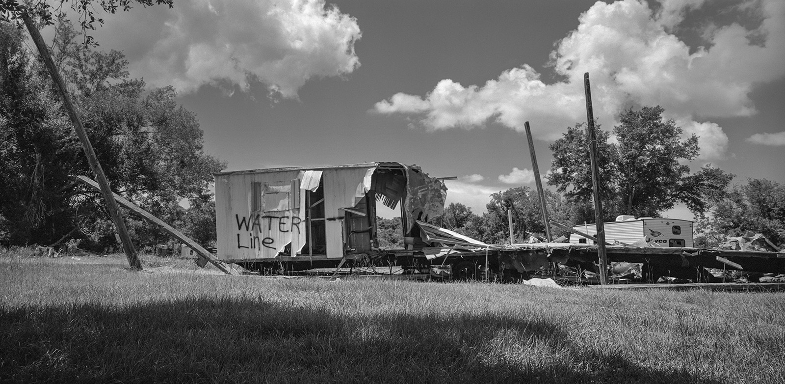
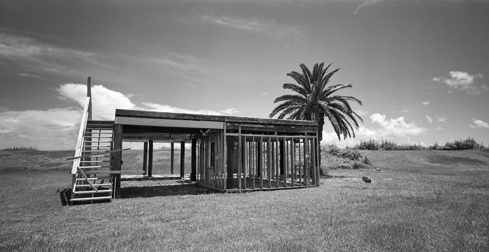
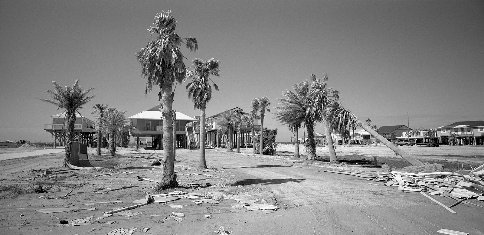
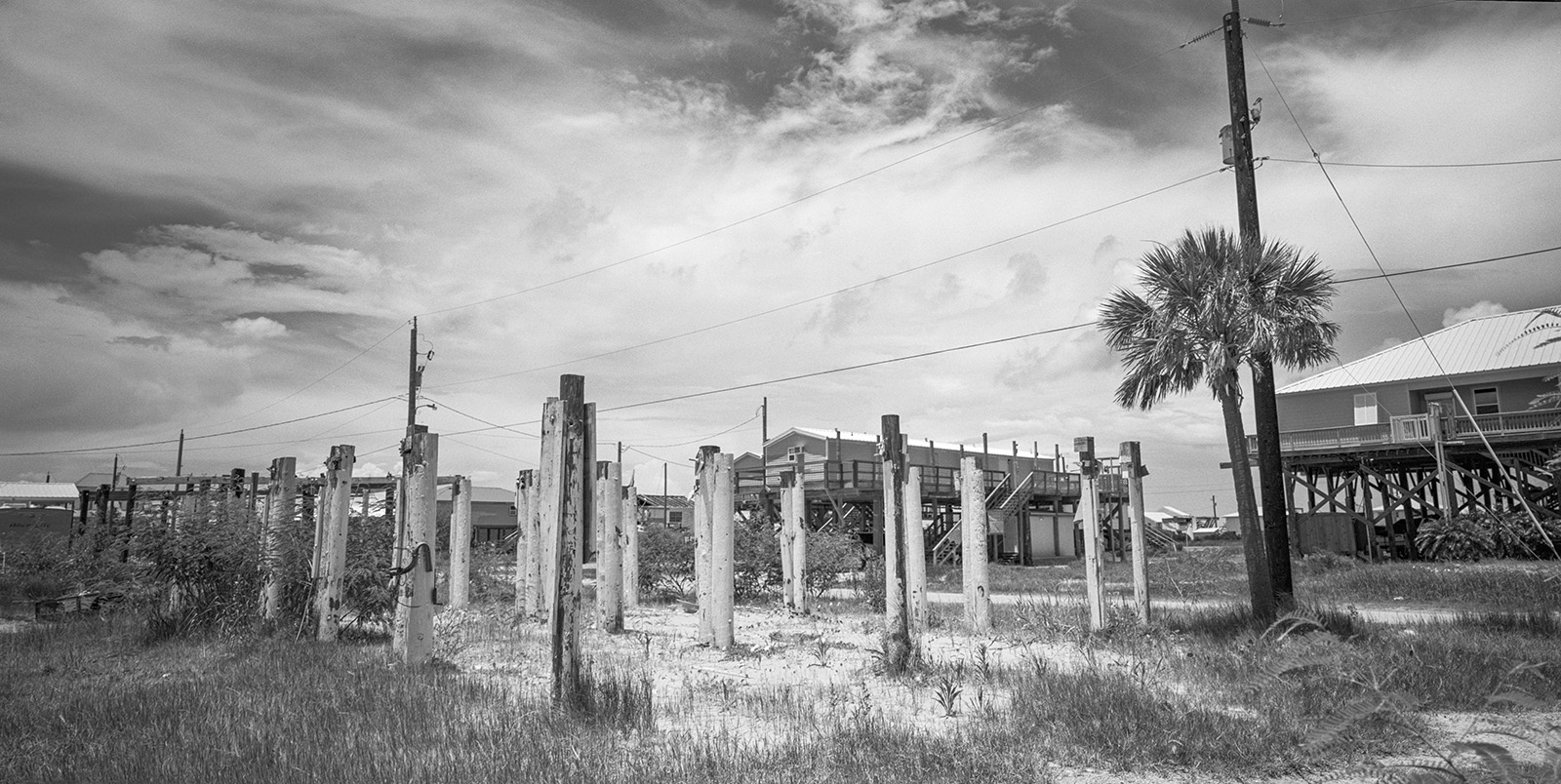
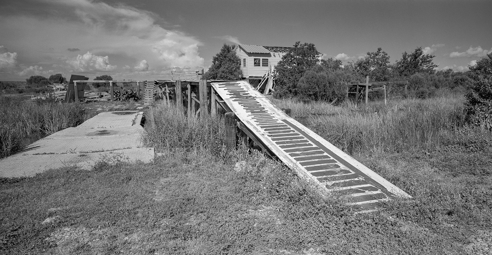
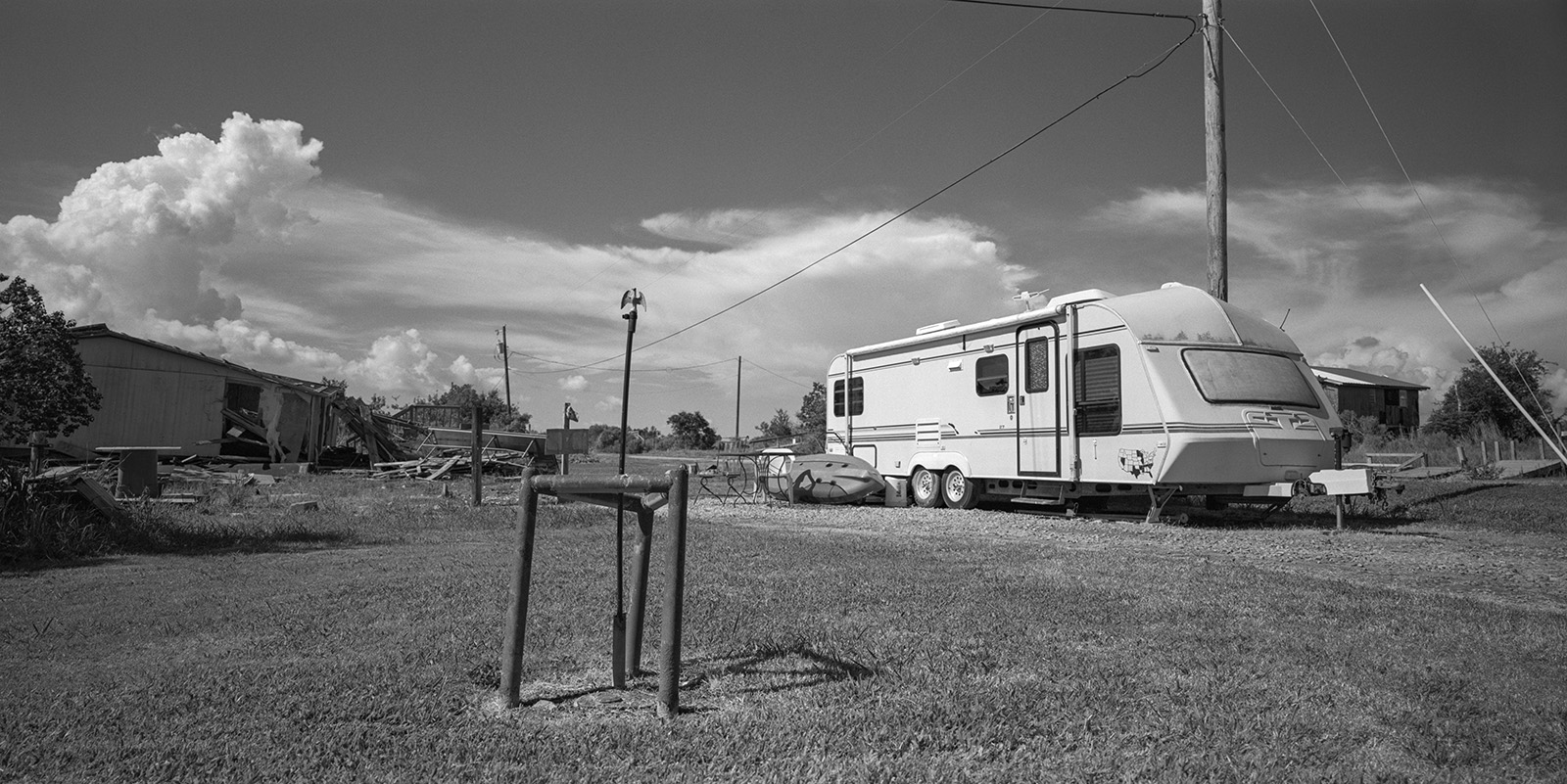
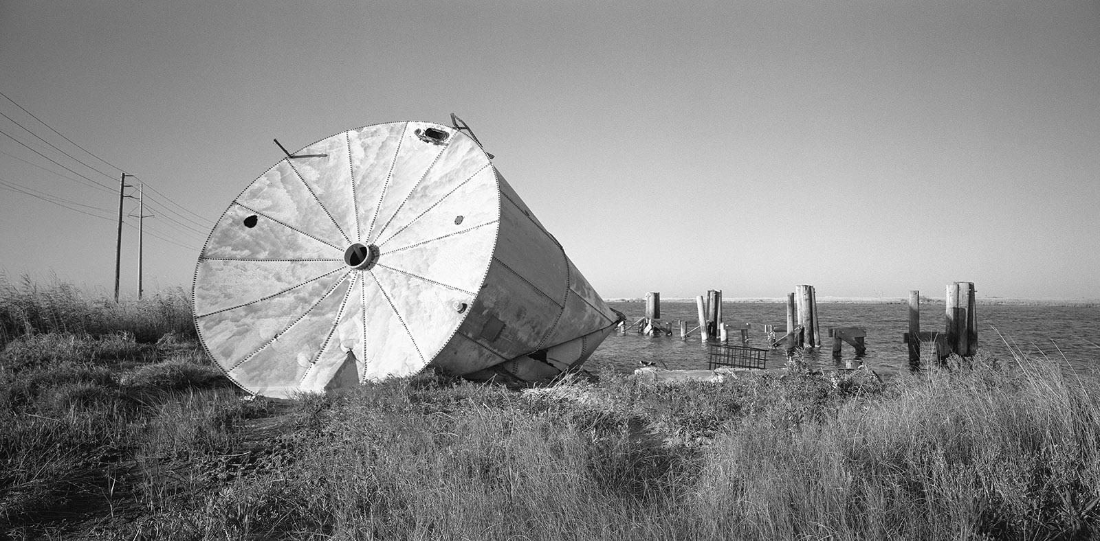
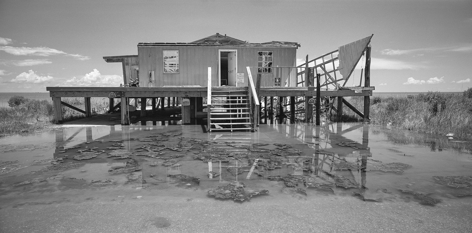
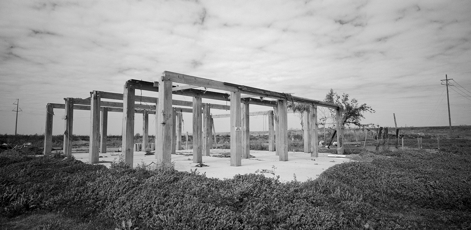
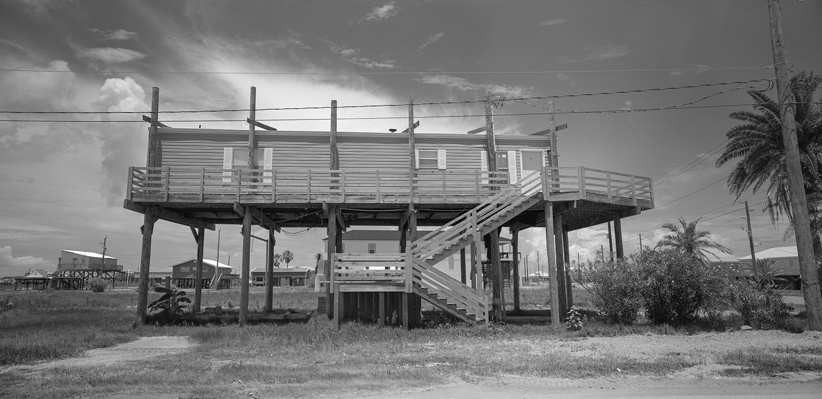
In addition to global sea level rise, and pollution, in this century alone, a dozen major storms, including Katrina and Rita in 2005, and Gustav in 2008, drastically changed the geography of Louisiana’s coast. On August 29th, 2021 Hurricane Ida caused catastrophic wind damage and flooding in the area. following Port Fourchon landfall, it rendered towns of Grand Isle and Golden Meadow nearly uninhabitable.
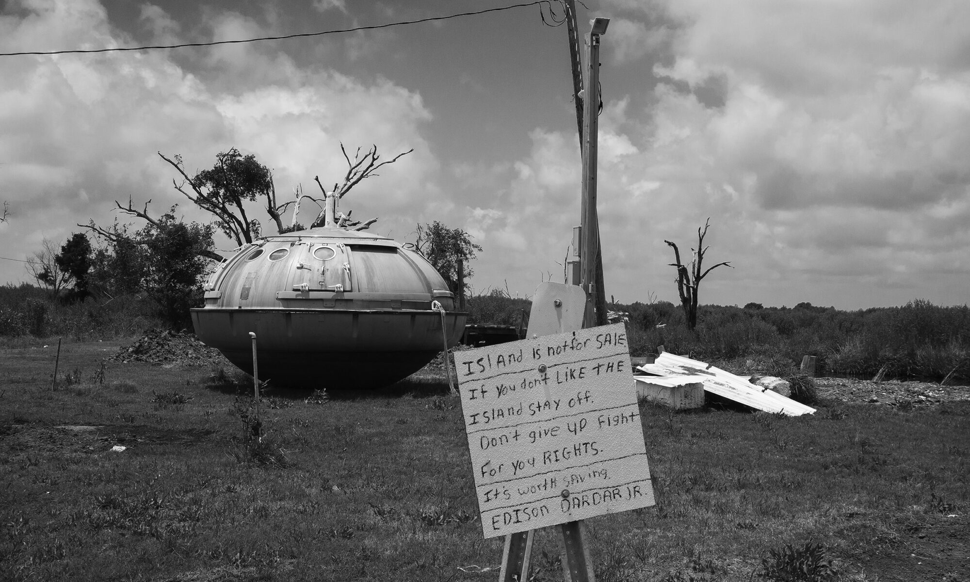
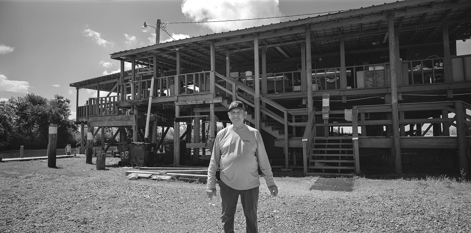
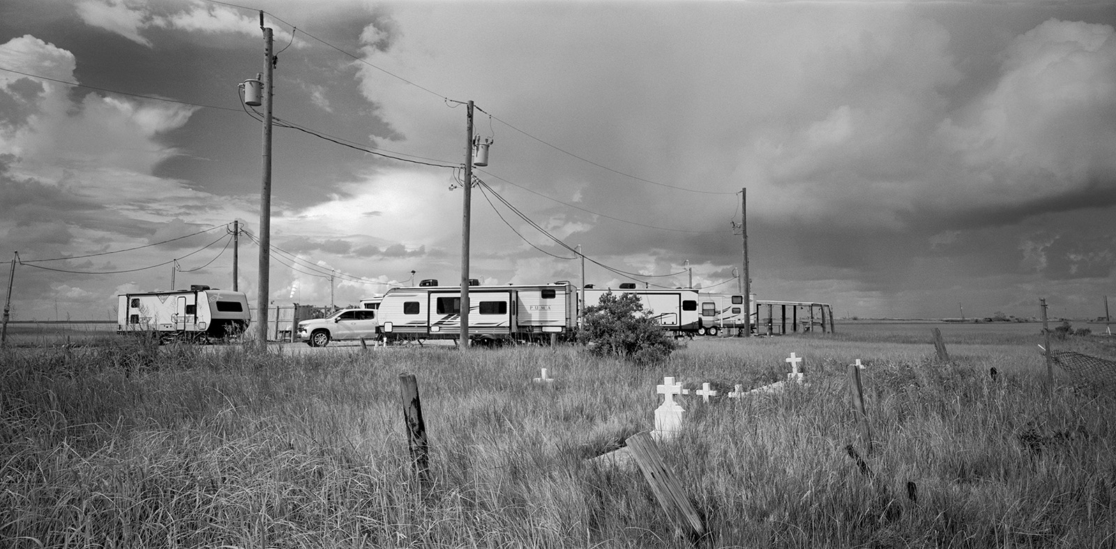
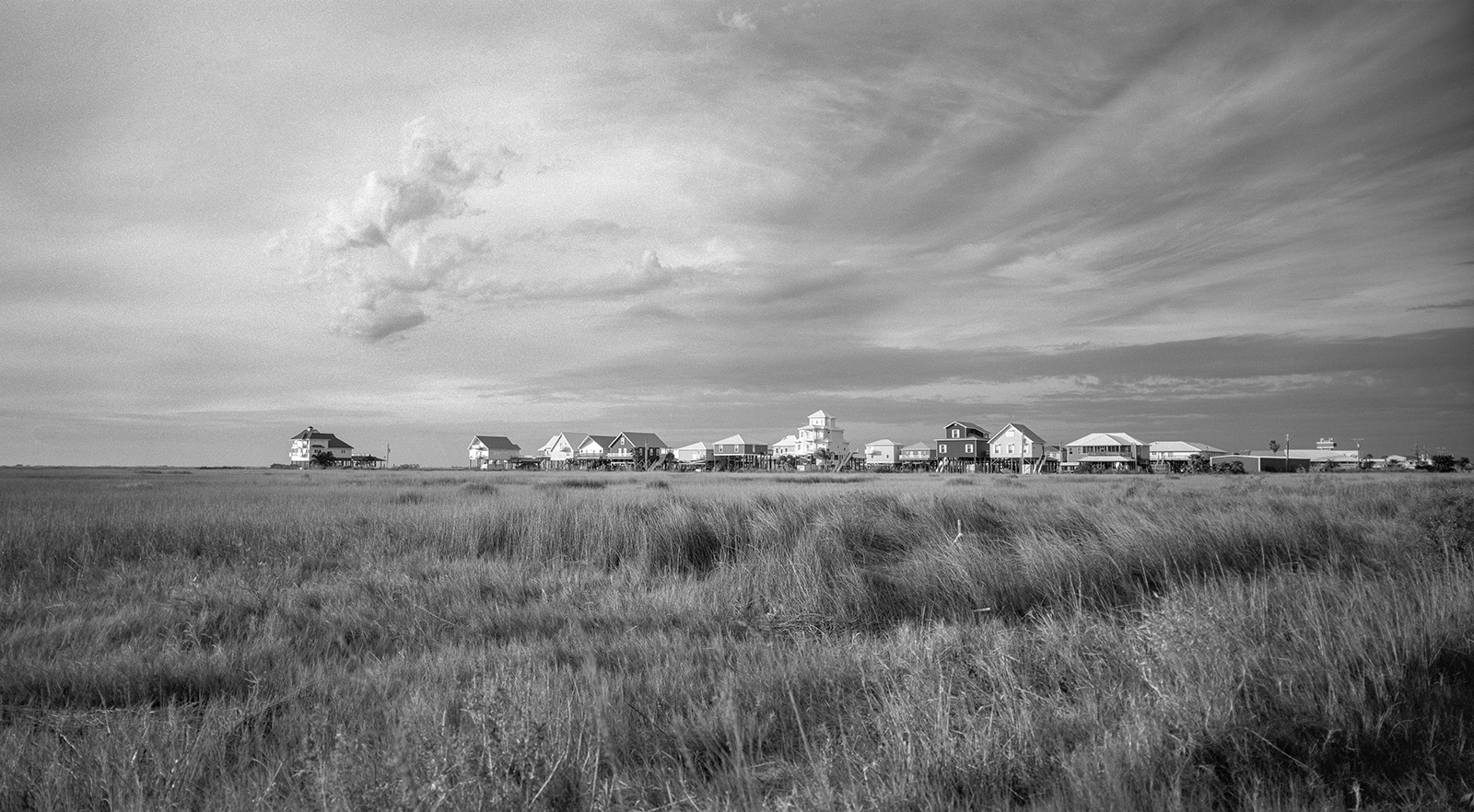
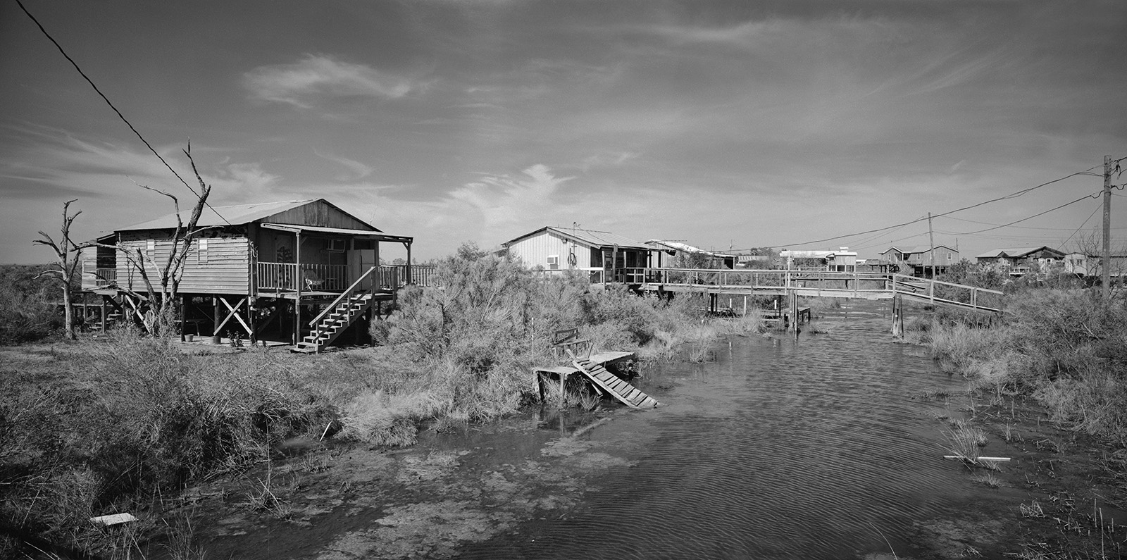
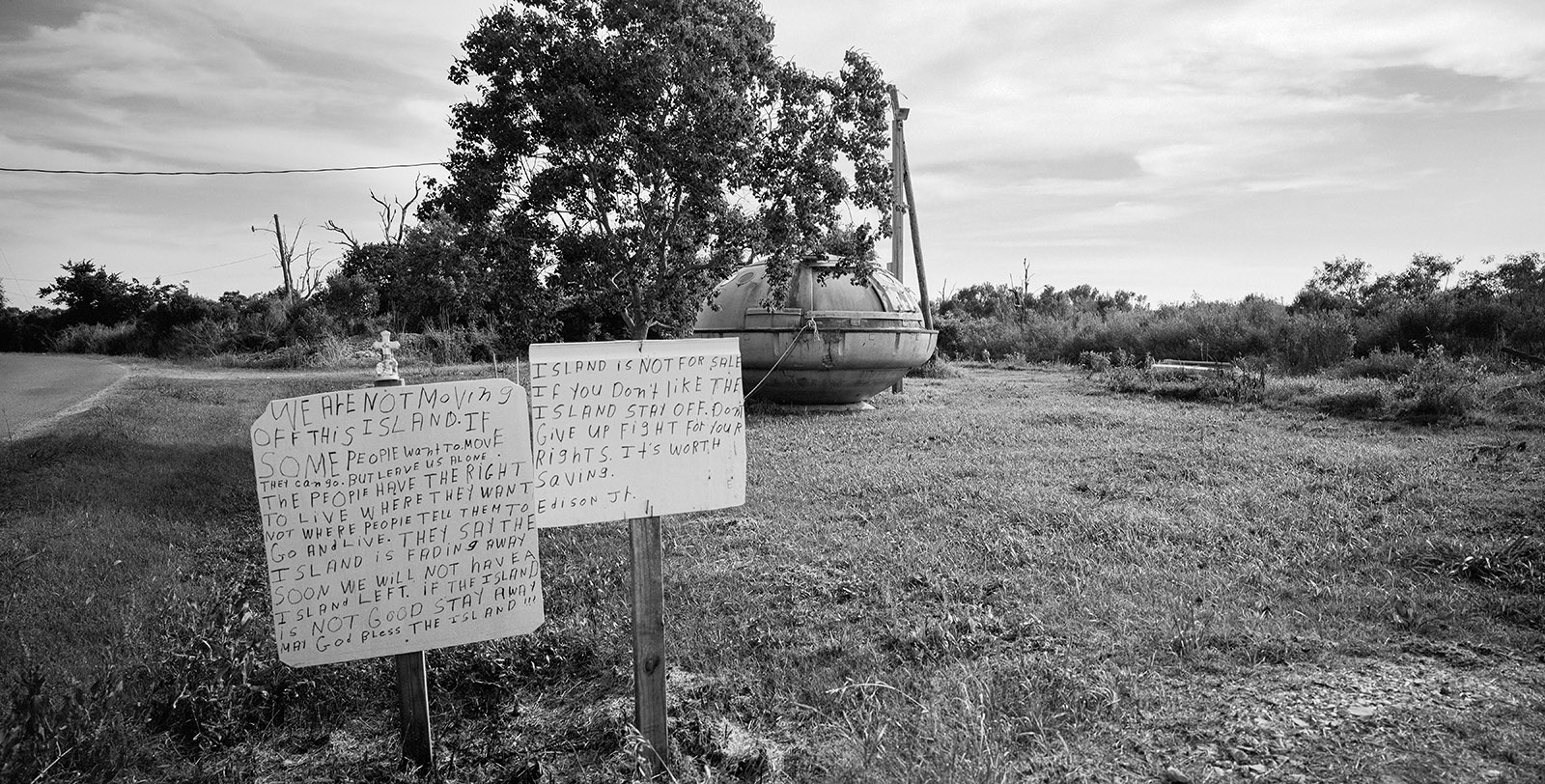
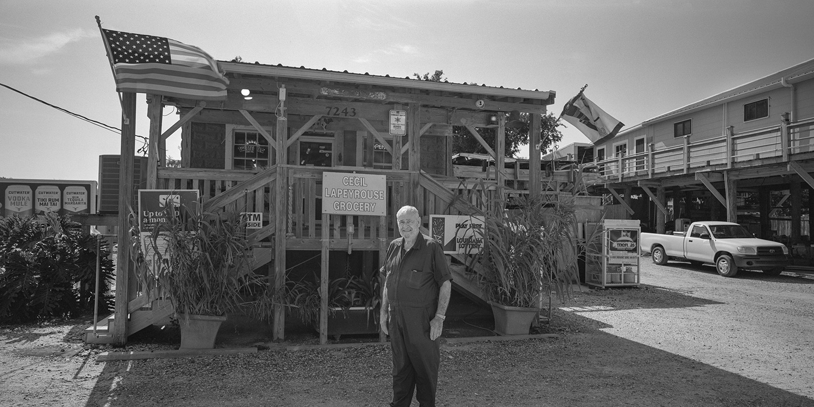
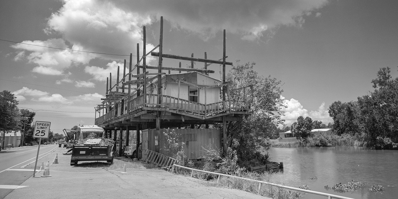
People of Louisiana are closely defined by the landscape they inhabit. Unfortunately, this fascinating correlation between people and geography is under a dire threat of vanishing simply because the land they occupy is physically retreating. Our modern technology and engineering is capable of physically slowing the coastal erosion, but it is not very good at preserving the cultural heritage. Many of South Louisiana’s communities, including Indigenous Americans, Cajuns, and Asian Americans are affected by loss of natural resources, economic impact, and direct loss of property. Every year, small local communities are abandoned and gradually sink into the wetlands. One of such places, Isle de Jean Charles, is a historical home of Biloxi-Chitimacha-Choctaw people. In the past 60 years the community lost over 98 percent of their land due to rising sea levels. In 2016, U.S. Department of Housing and Urban Development allotted 50 million USD for community resettlement. Many choose to remain on the land they occupied since 1830s.
This is a story of challenges and adaptations. This project layers cultural documentary and environmental concerns by presenting Louisiana’s wetland issues in context of our global cultural-environmental situation. This subject is a proverbial “canary in the mine” for problems affecting the entire planet. It is the longest undertaking of my career so far, chronicling the continuous shifting of the landscape and adaptation of humanity to our new, warmer and wetter world.
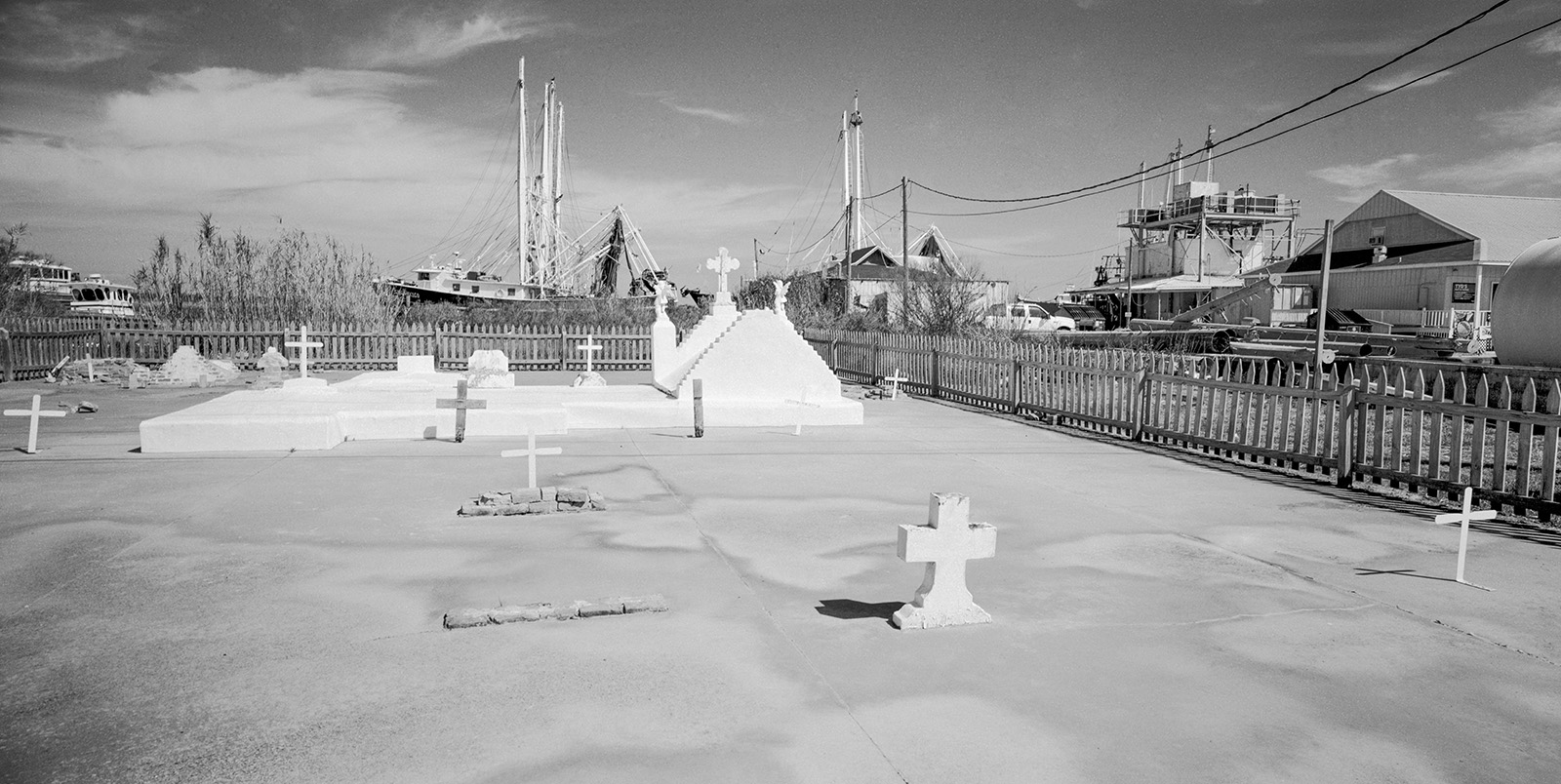
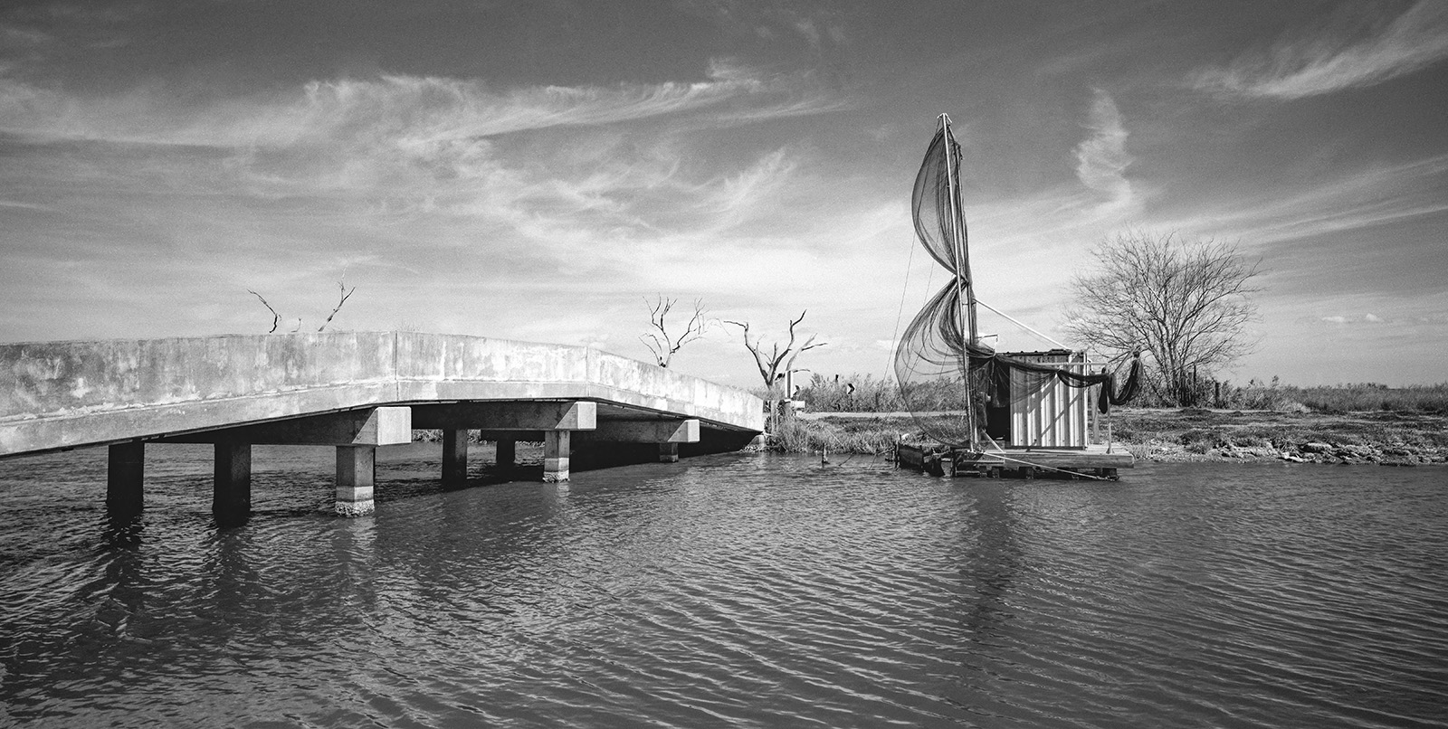
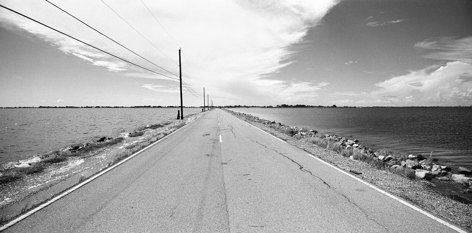
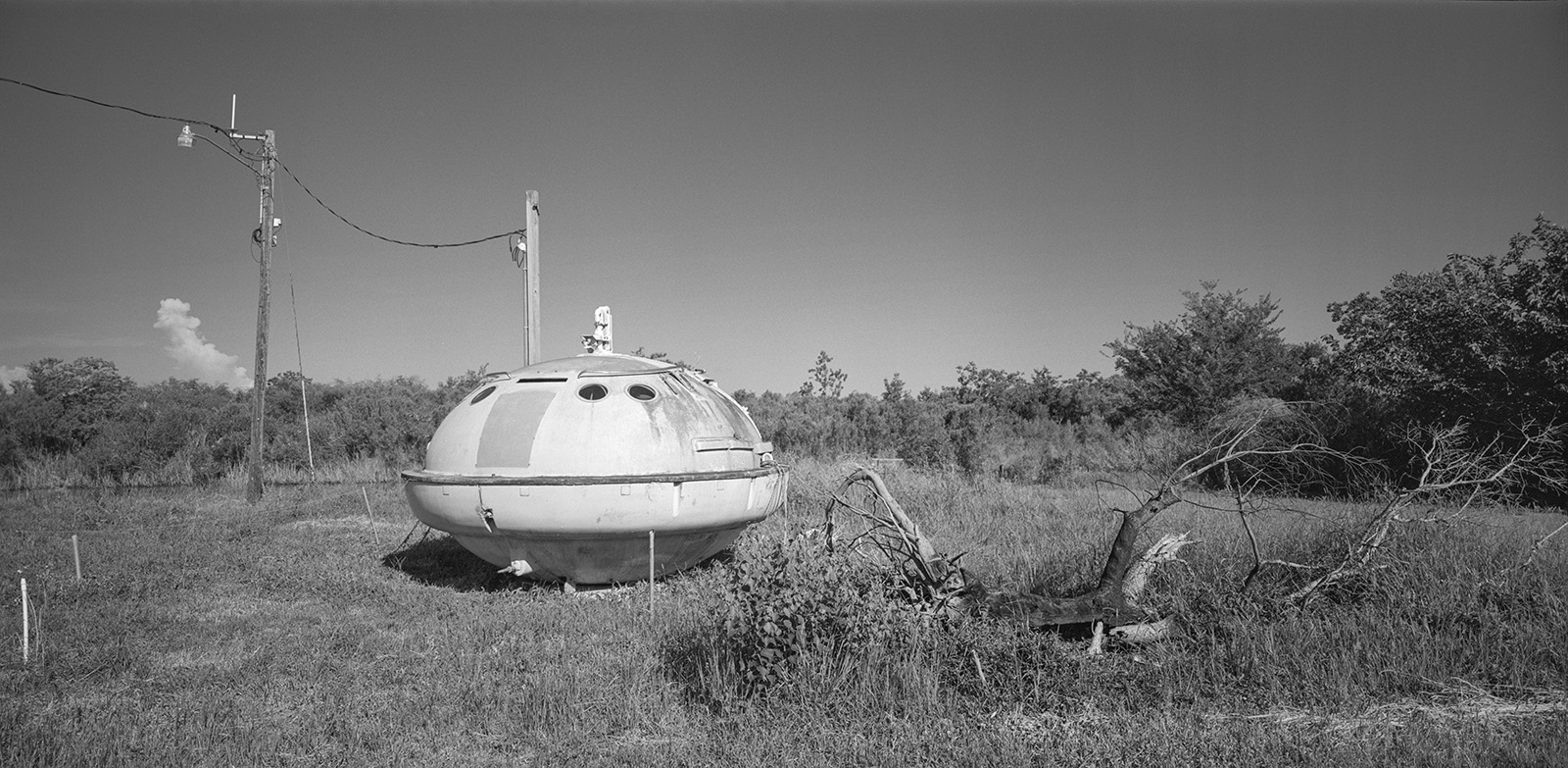
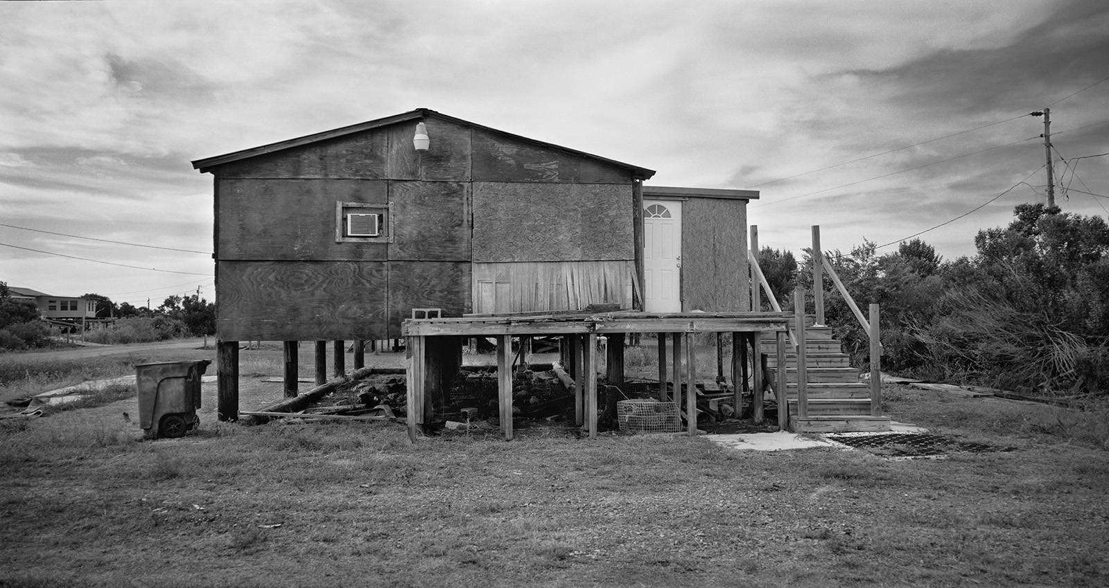
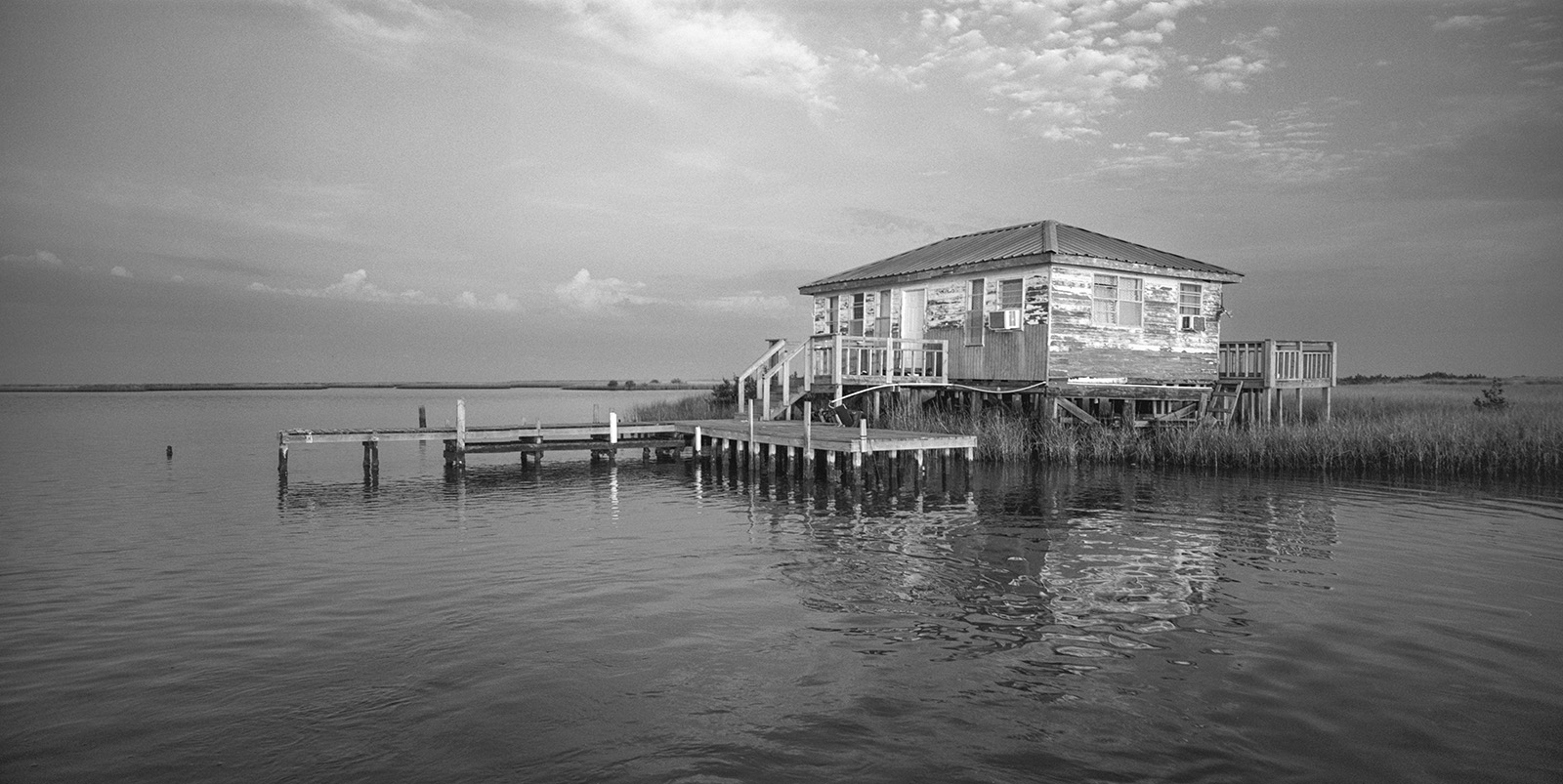
Highest Water Line, Pointe Aux Chenes, Louisiana, 2023
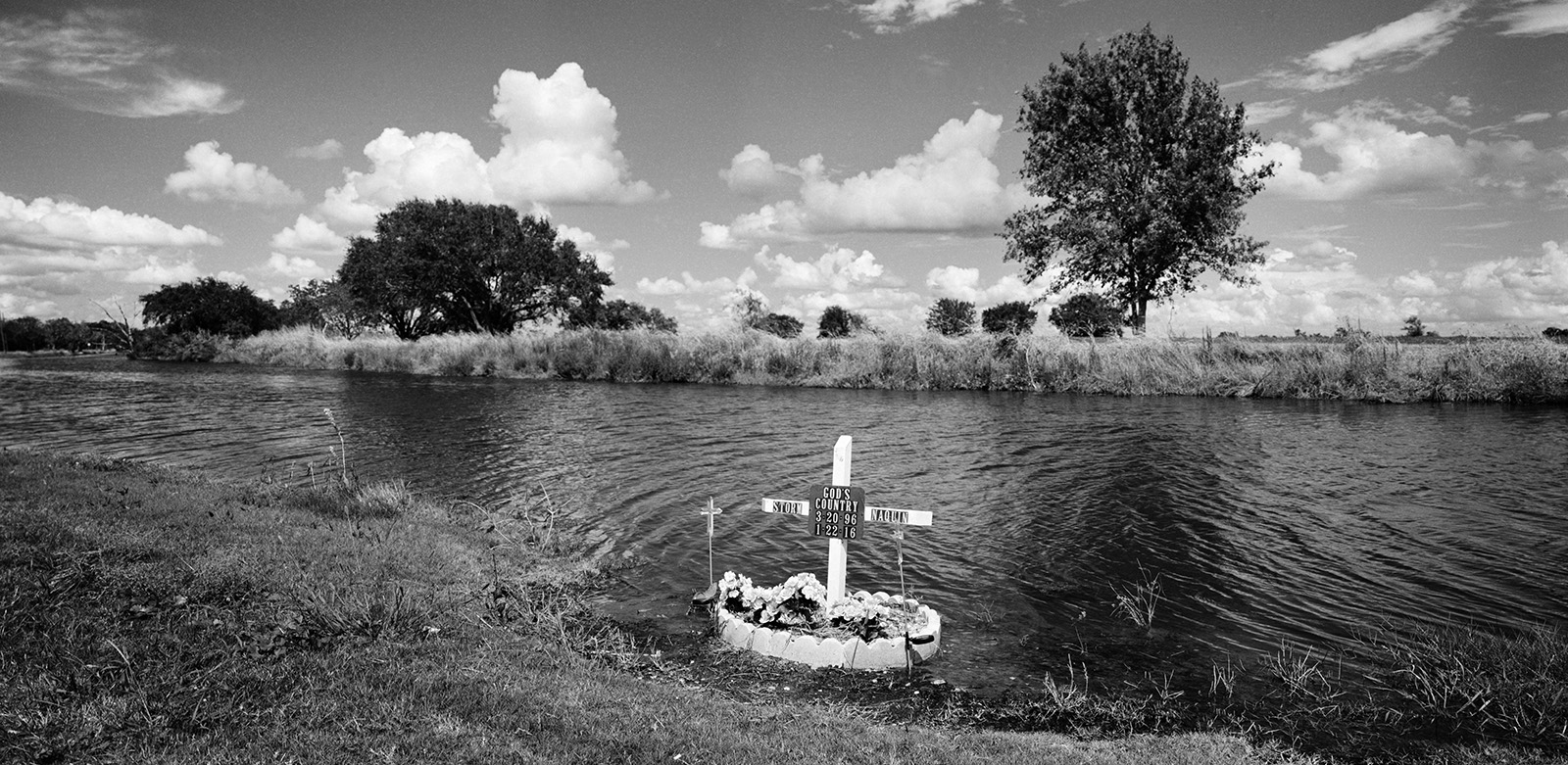
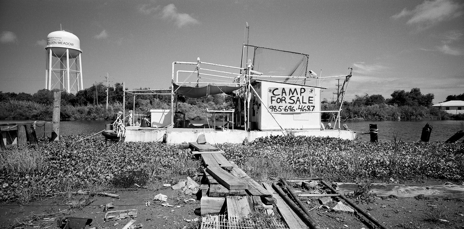
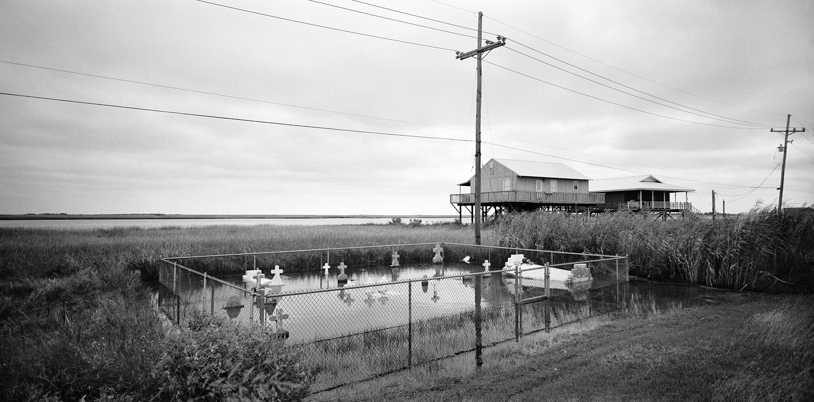
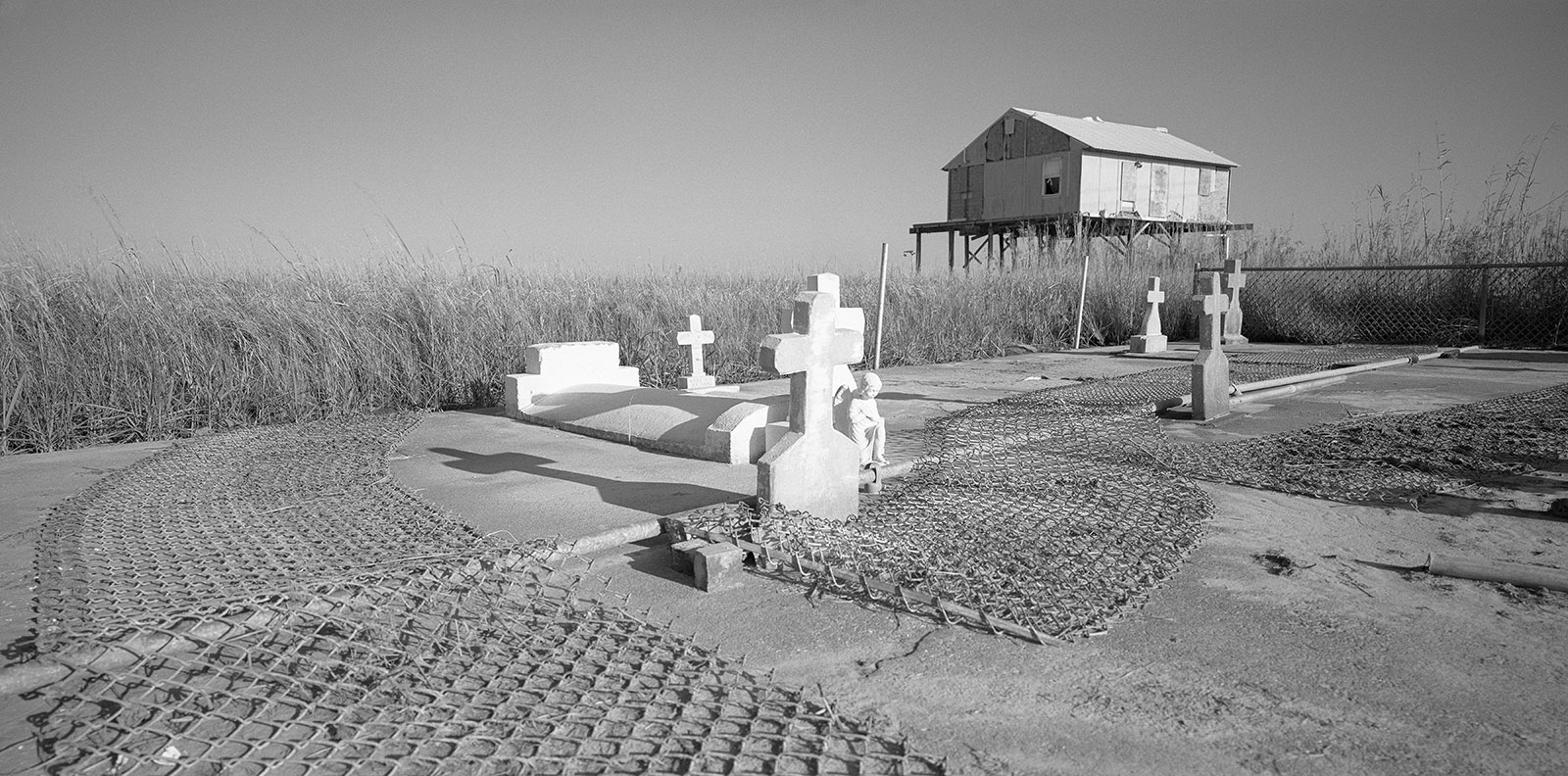
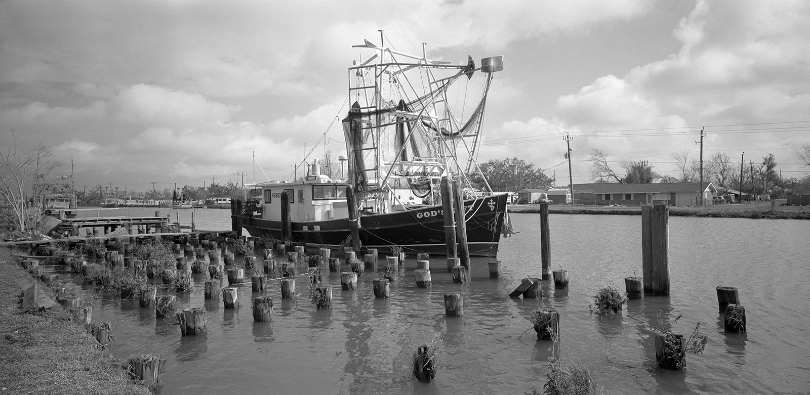
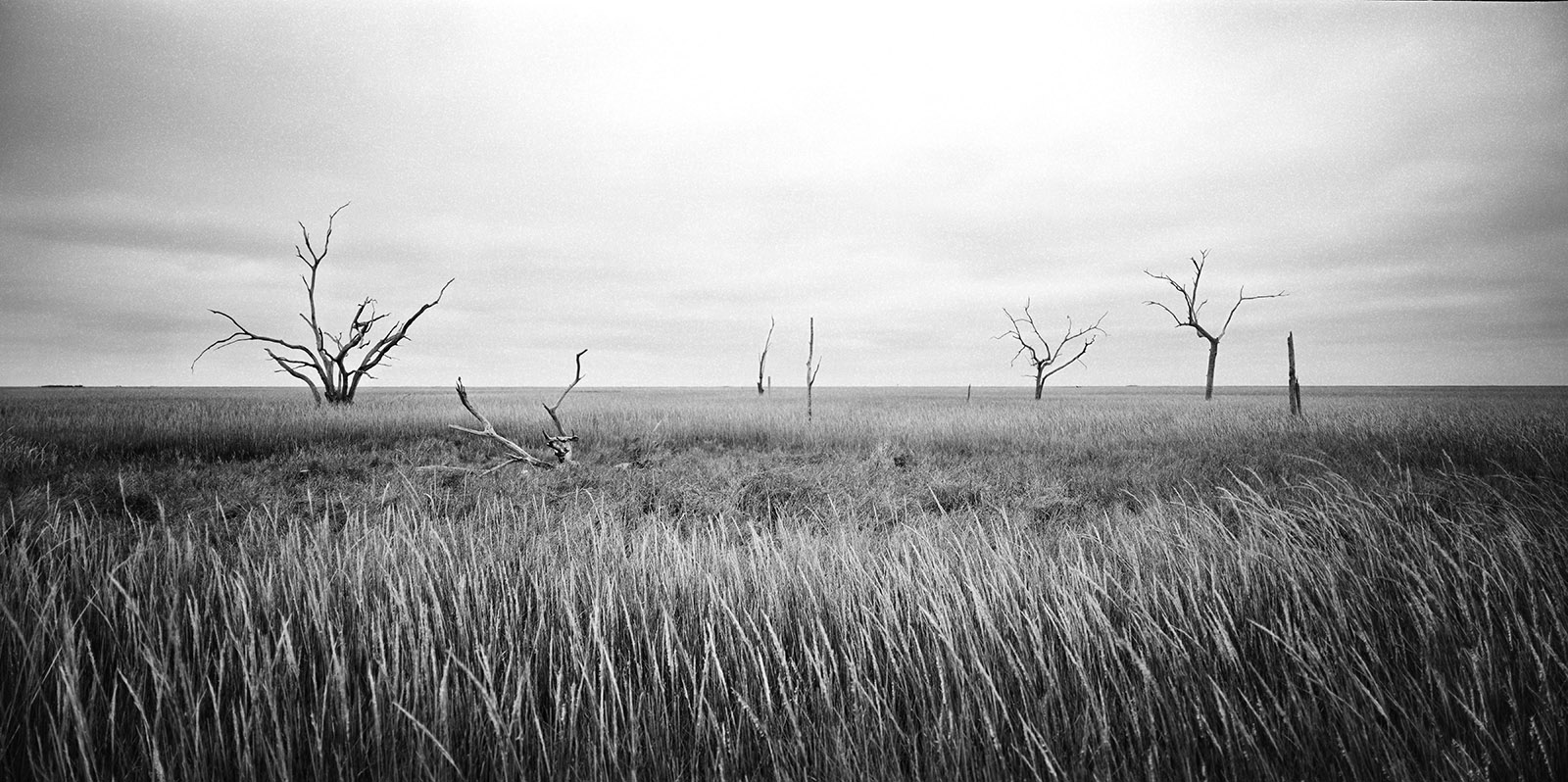
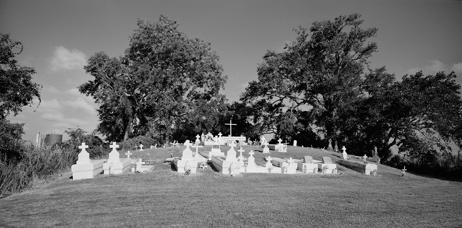
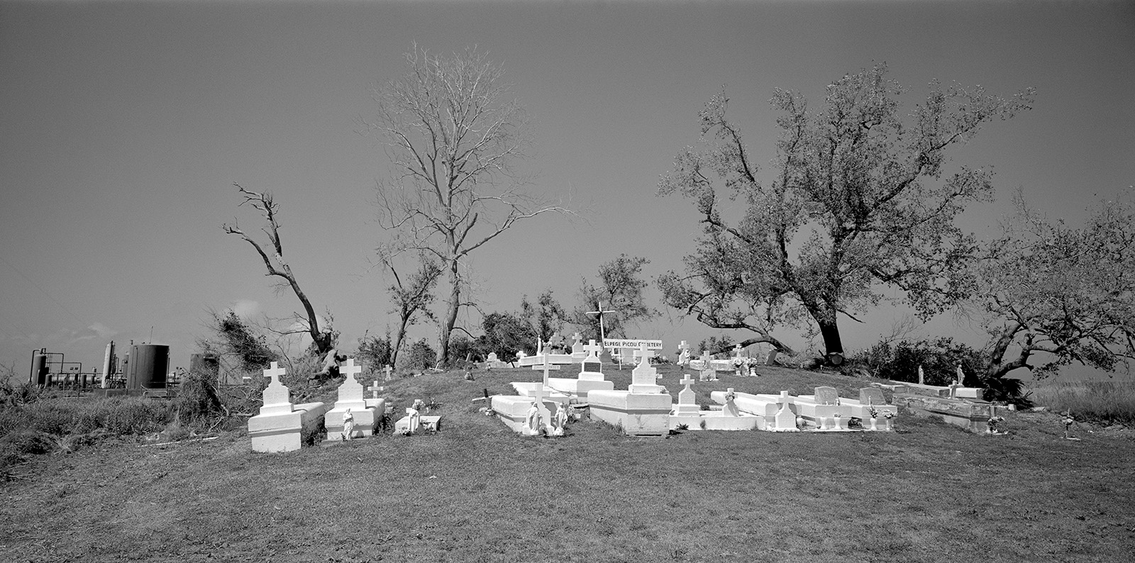
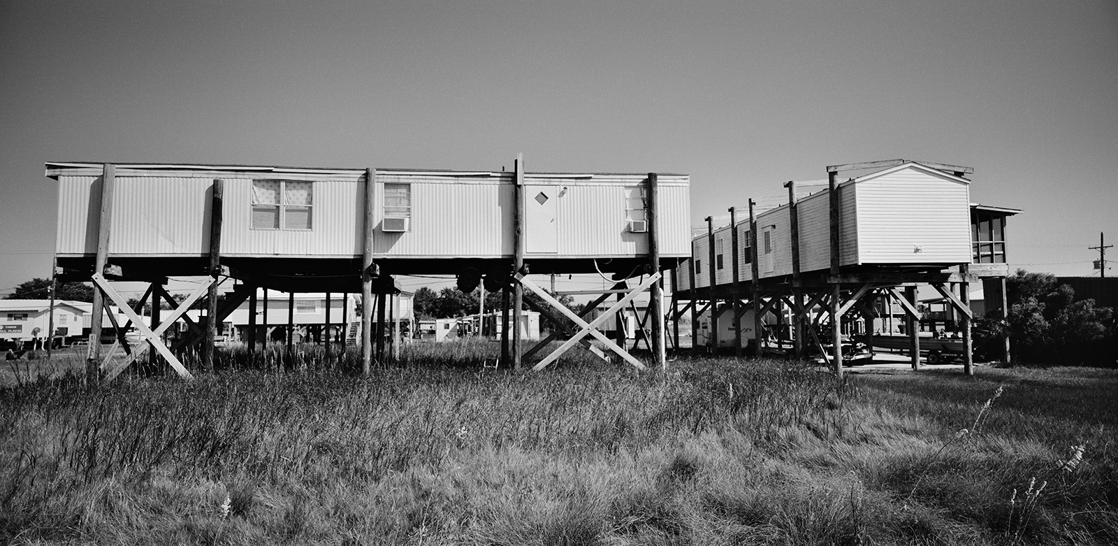
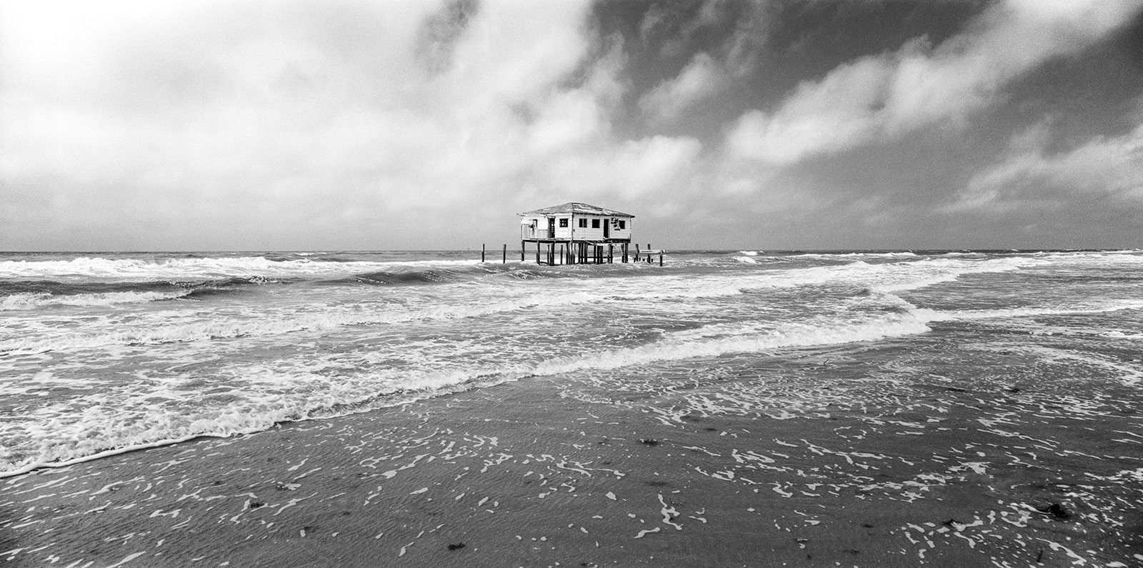
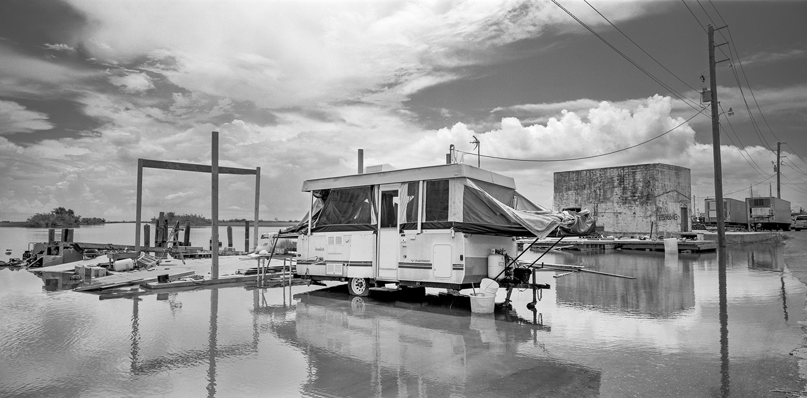
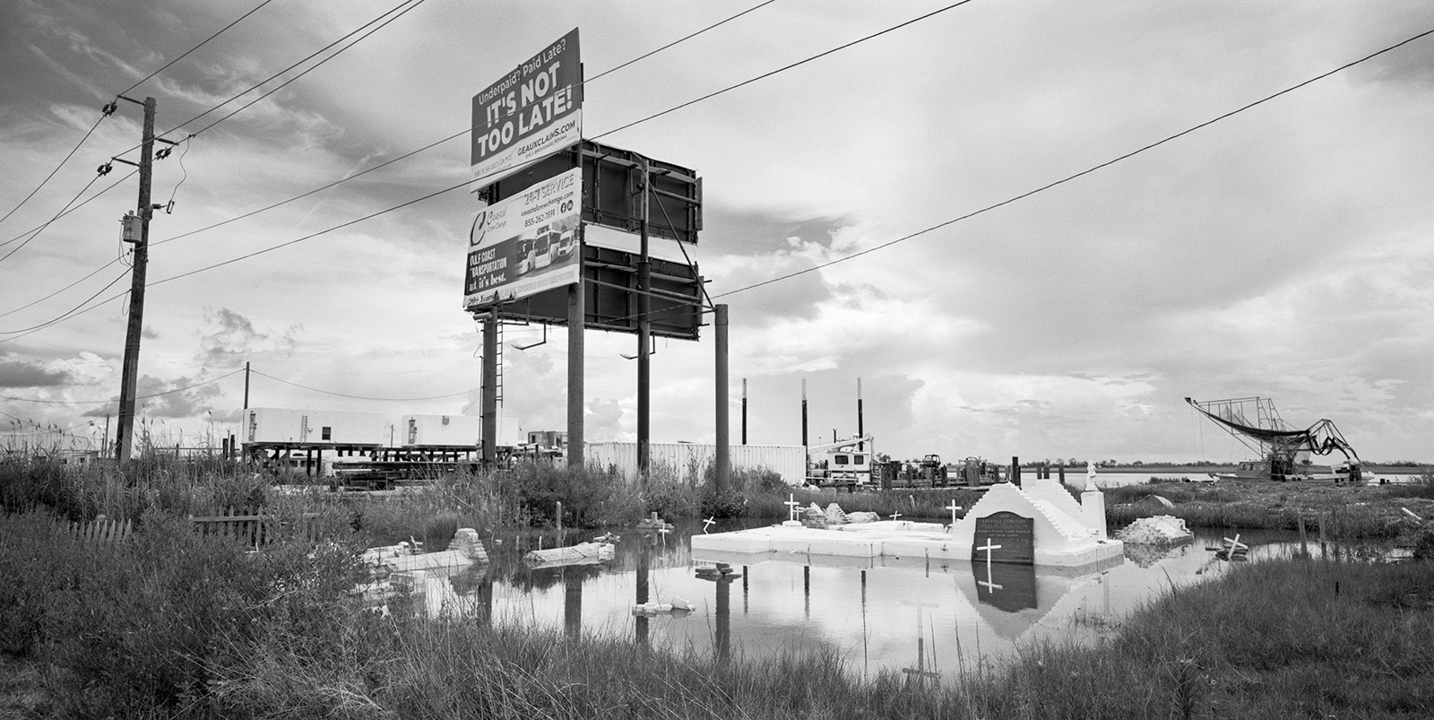
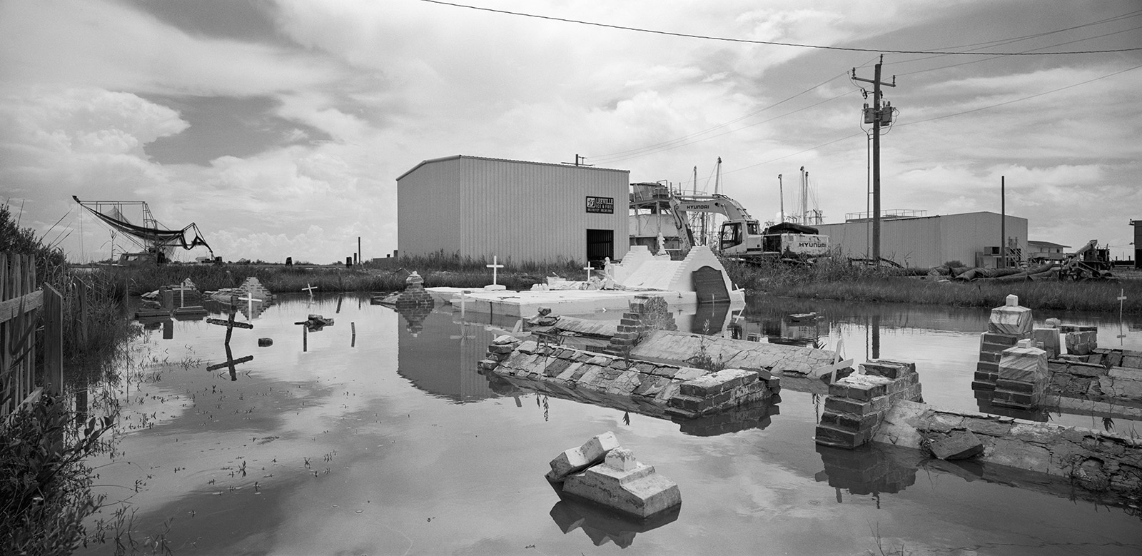
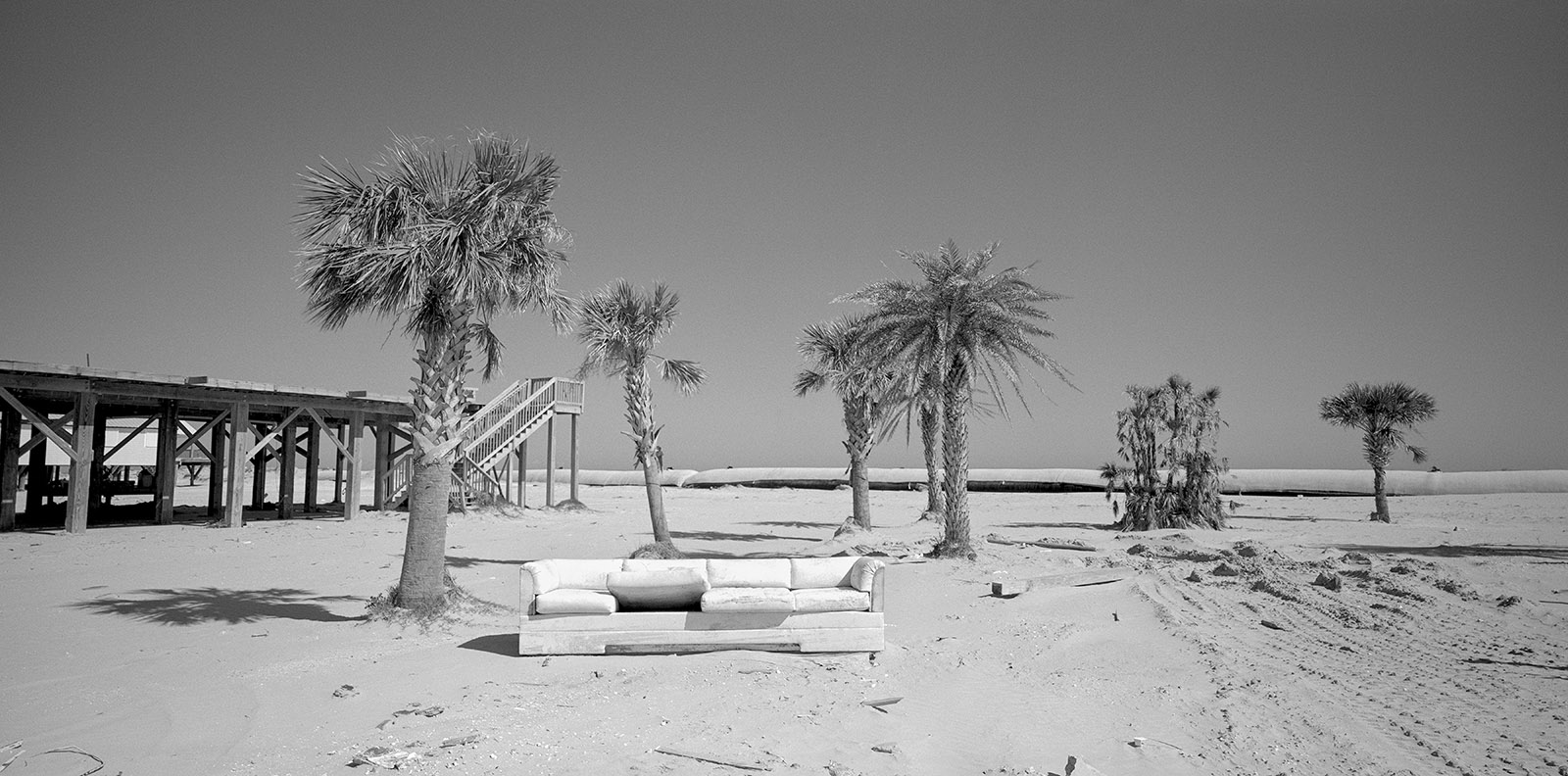
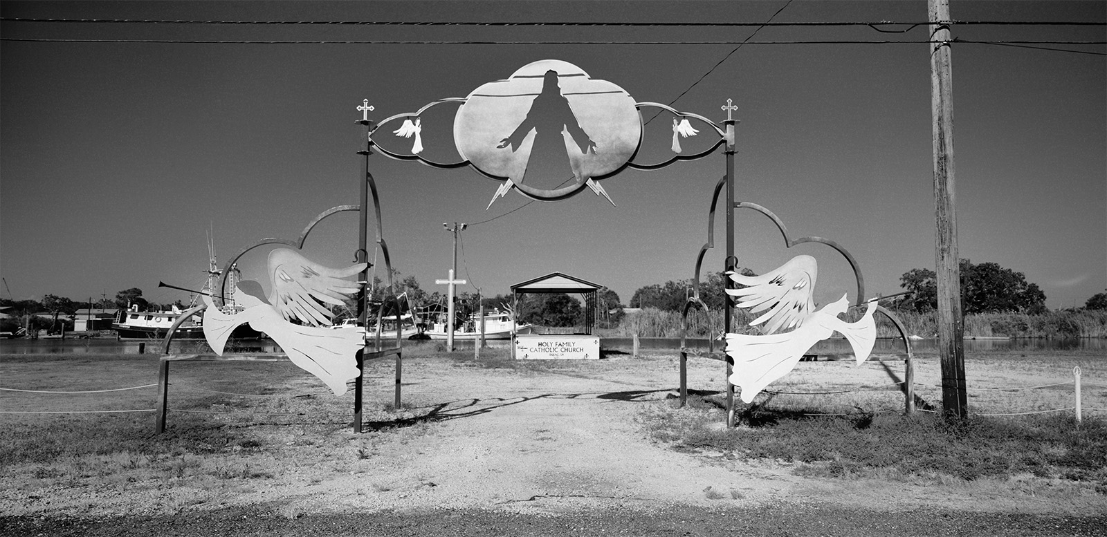
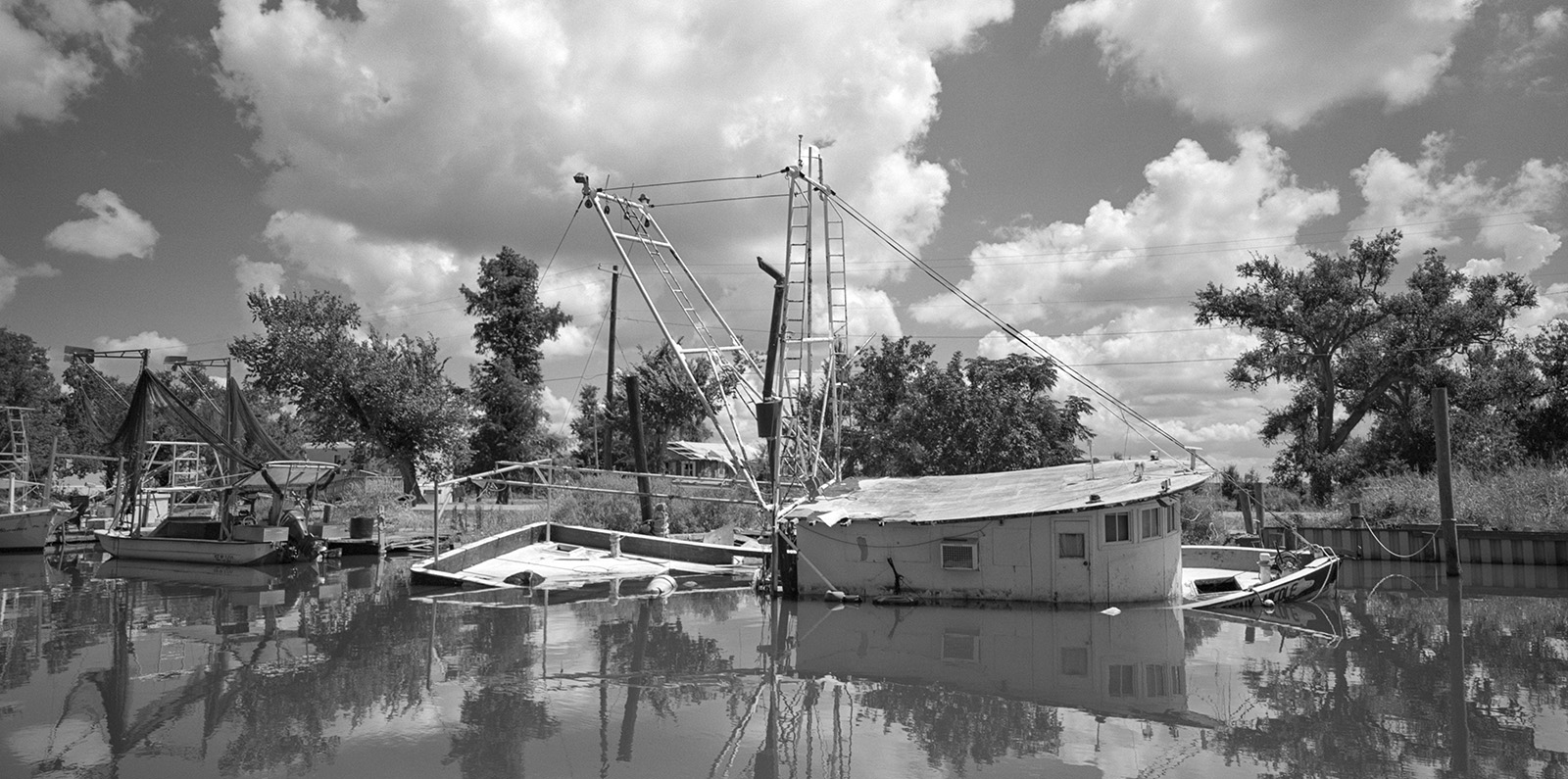
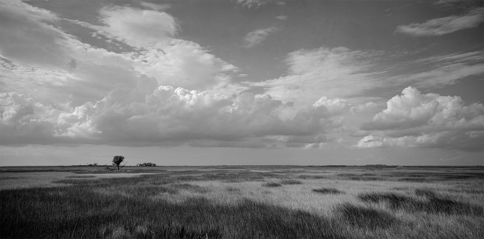
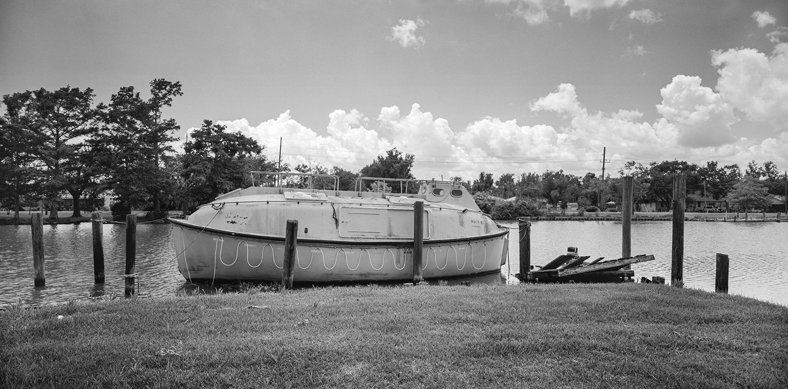
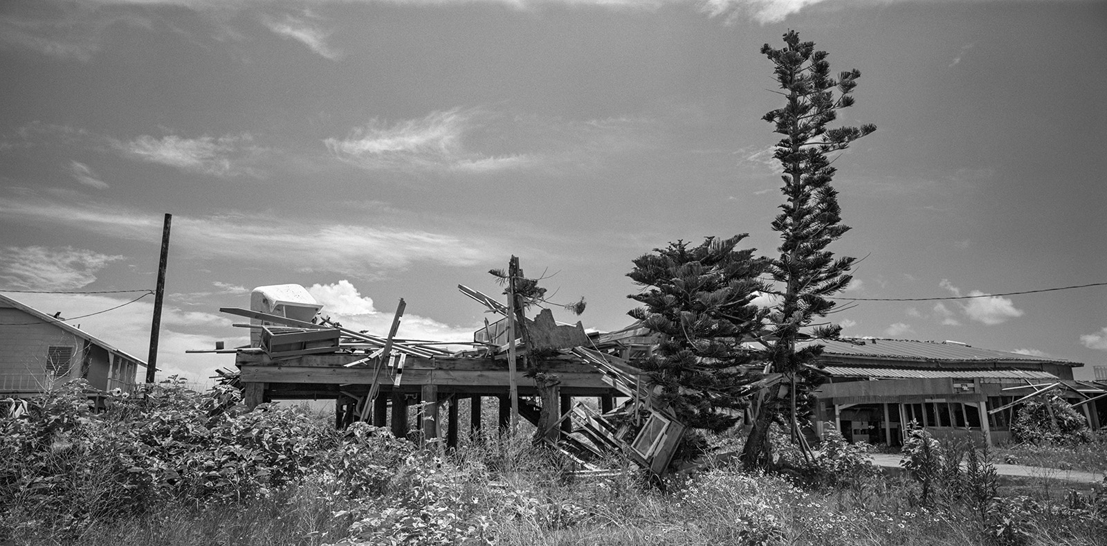
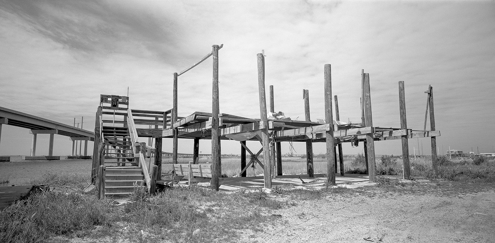
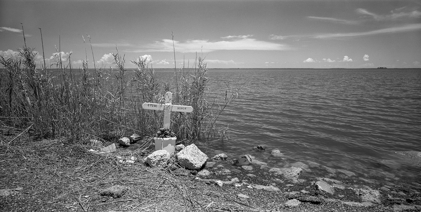
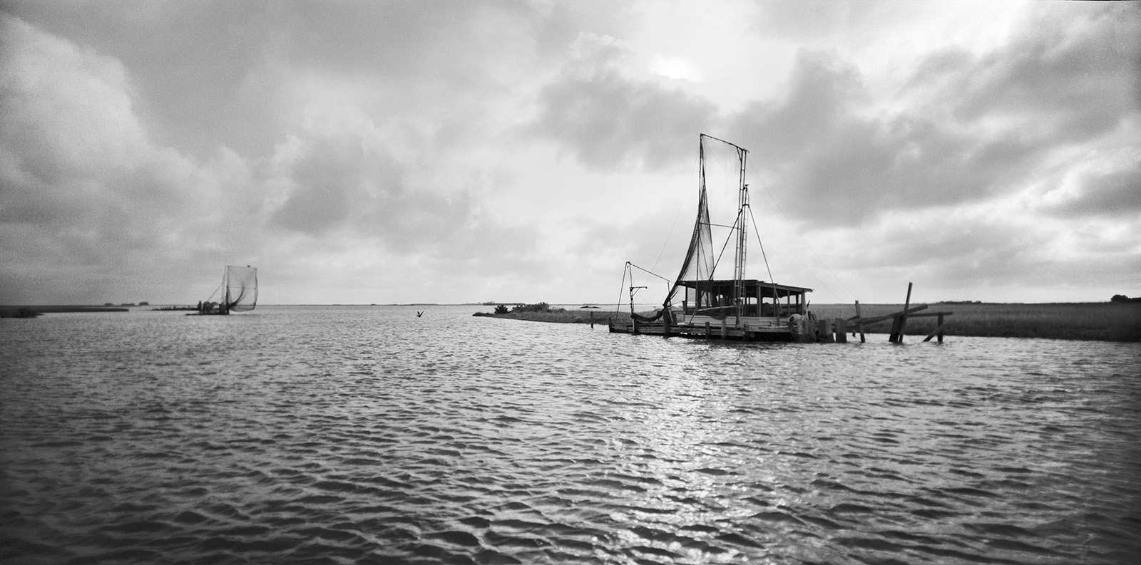
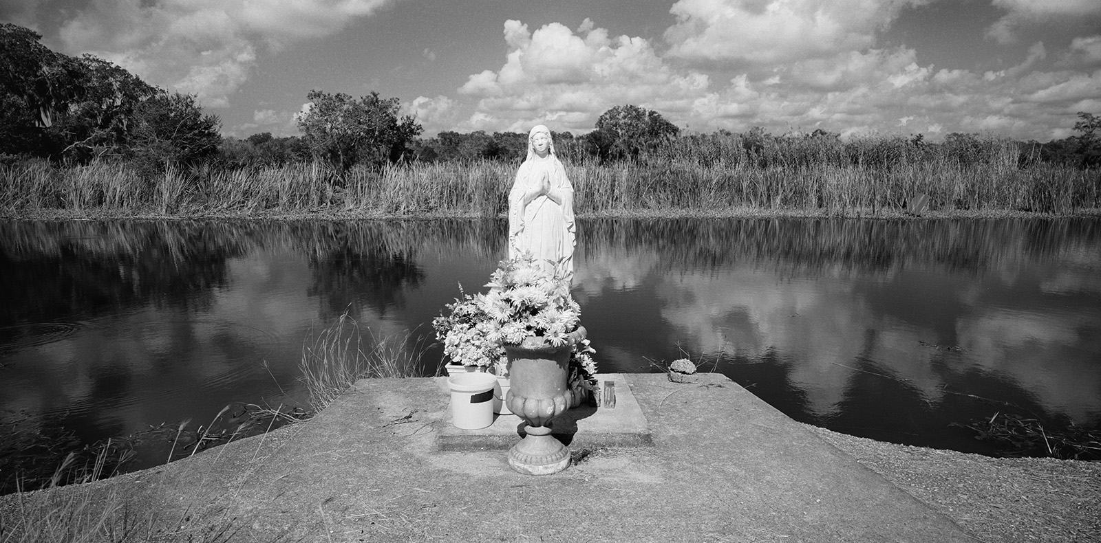
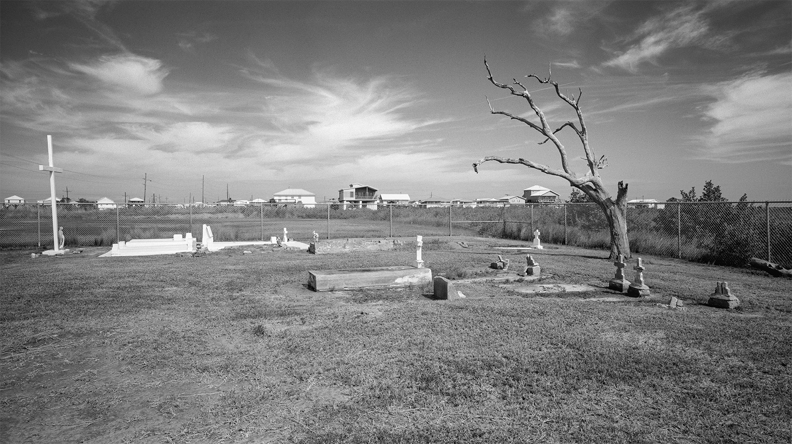
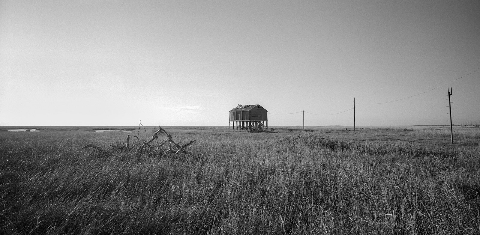
Storm Naquin in God’s Country, Pointe Aux Chenes, Louisiana, 2019Camp for Sale, Golden Meadow, Louisiana, 2022Graveyard Under Water, HWY 1, Louisiana, 2019Fallen Fence, Cemetery, HWY 1, Louisiana, 2022Gods Gift, Louisiana, 2022Dead Cheniere, Hwy 1, Louisiana, 2022E Picou Cemetery, Louisiana 2019E Picou Cemetery, Louisiana, 2022Skeleton Roof, Louisiana, 2022Raised Trailers, HWY 56, LouisianaThe Last Camp, Isle Dernière, Louisiana, 2018Fleetwood Popup, Leeville, Louisiana, 2023Leeville Cemetery, Louisiana, 2016Not Too Late, Leeville Cemetery, Louisiana, 2023Leeville Cemetery, Louisiana, 2023White Couch, Grand Isle, Louisiana, 2022Bottom of the House, Grand Isle, Louisiana, 2023Palms, Grand Isle, Louisiana, 2022Steps, Isle De Jean Charles, Louisiana, 2023Trailers and Graveyard 2023, Louisiana, 2023Town of Cocodrie, LouisianaHoly Family, Dulac, Louisiana, 2019Brittany Nicole, Bayou Pointe Aux Chenes, Louisiana, 2023Prairie, Bayou Salé, LouisianaLife Boat, Bayou Terrebonne, Louisiana, 2023House, Pine, Grand Isle, Louisiana, 2023Trailer Skeleton, Leevile, Louisiana, 2022Steve Roach, HWY 55, Louisiana, 2023Petit Caillou Bridge Shed, Louisiana, 2019Island Road, Isle De Jean Charles, Louisiana, 2019Life Raft, Isle De Jean Charles, Louisiana, 2023Isle De Jean Charles Canal, Louisiana, 2017Walkway, Isle De Jean Charles, Louisiana, 2017House Walkway, Isle De Jean Charles, Louisiana, 2023Camper, Isle De Jean Charles, Louisiana, 2023Bridge, Isle De Jean Charles, Louisiana, 2023House, Isle De Jean Charles, Louisiana, 2017Steps, Isle De Jean Charles, Louisiana, 2023Eddison Dardar’s Dign, Isle De Jean Charles, Louisiana, 2017Camp with Paupiere Net, Bayou Salé, Louisiana, 2023Salt Intrusion Des AlemondsSteel Tank, HWY 1, Louisiana, 20222527 HWY 55, Louisiana, 2023Keep Out, Louisiana, 2022Fishing Shed with Paupiere Net, Bayou Salé, Louisiana, 2017Cecil Lapeyrouse, Grocery Owner, HWY 56, , Louisiana, 20233B Camp, Bayou Salé, Louisiana, 2023Raised Mobile Home, Grand Isle, Louisiana, 2023Abandoned Boat, HWY 55, Louisiana, 2023Camp Old Glory, Bayou Salé, Louisiana, 2023Grand Isle Coastal Erosion, Louisiana, 2017Grand Isle Erosion Management, Louisiana, 2019Grand Isle Levee, Louisiana, 2023Sulfur Mine Island1138 Hwy 55, Montegut, Louisiana, 2023Dry Dock, HWY 56, Louisiana, 2019Draw Bridge, Golden Meadow, LouisianaFishing Camps, Bayou Salé, LouisianaBayou Dularge Road Madonna, Louisiana, 2017Cocodrie Row, HWY 56, LouisianaBayou Salé Camp, LouisianaChenieres Cemetery, HWY 1, Louisiana, 2019Lone Camp, Louisiana, 2022White Camp, Bayou Salé, Louisiana, 2023